In Geologic Time

In Geologic Time

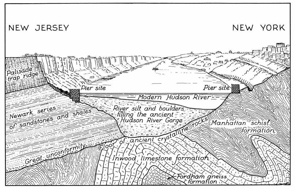
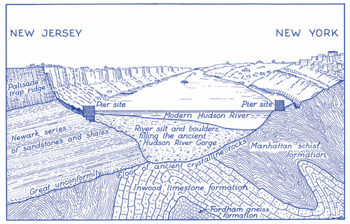
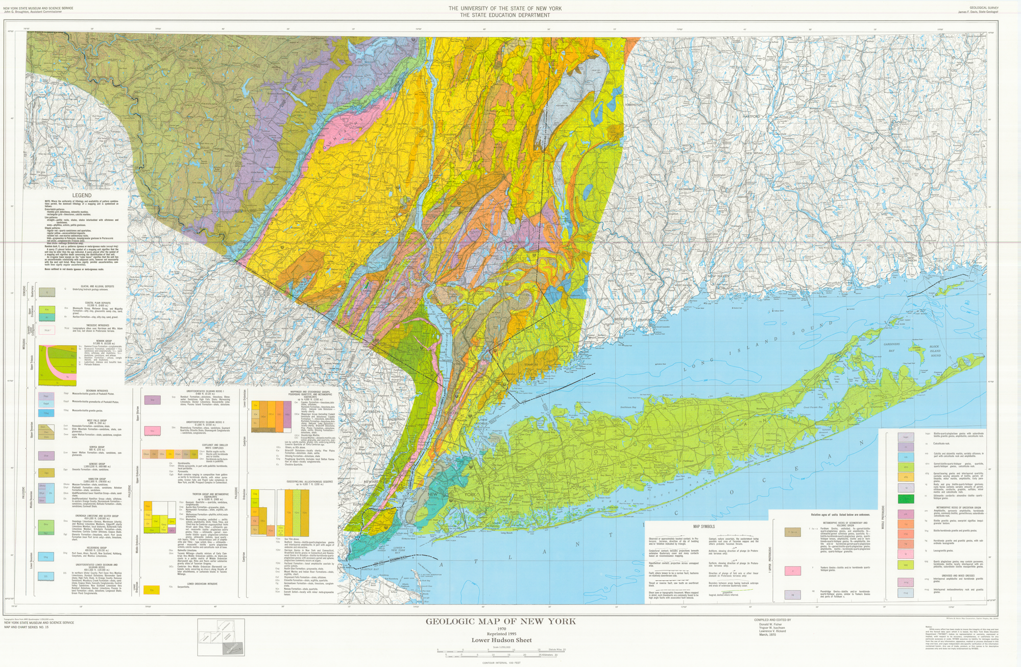
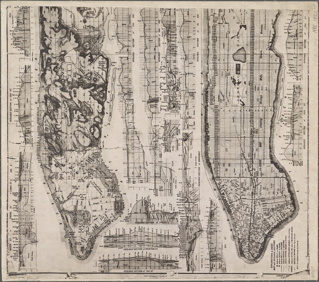
Much of New York State’s bedrock and the Adirondack Mountains were formed by ancient Precambrian crystalline basement rock forms. About 450 million years ago the biotite-rich bedrock (made of gray quartz and white orthoclase) known as the Manhattan Schist transformed from shale to metamorphic rock, and constituted part of Manhattan (from the Munsi language of the Lenni Lenape/Delaware “island of many hills”) during continental collision between the floor of the present-day Atlantic Ocean, and what would later be known as the East Coast of North America. In the area often referred to as midtown Manhattan, the bedrock lies within a few feet of the ground’s surface, and within 40 feet of the surface in lower Manhattan making skyscrapers possible, whereas accessing the bedrock was (and still is) cost-prohibitive at a depth of 4-5 times deeper in other parts of so-called New York City.

A line drawing map of the supercontinent Rodinia
Rodinia (from the Russian rodit, meaning “to beget, to give birth,” or rodina, meaning “motherland, birthplace”) is a supercontinent that assembled 1.1–0.9 billion years ago and broke up 750–633 million years ago.
A photograph of a large piece of rock sandwiched between two buildings, as seen from the street. The rock reaches the second floor of the adjacent buildings. There are two cars a, a tree, and a street sign in front of the rock. It is fenced in with wire fencing.
An outcrop of Manhattan schist on Bennett Avenue in the Washington Heights neighborhood of Manhattan, New York City. The outcrop lies where West 182nd Street would normally be. Image: Beyond My Ken / Creative Commons License 
A photo of a piece of bedrock
Mica schist from the Precambrian of New York State. (1.8 inches across at its widest). Rock outcrops occur in several city parks of Manhattan, including the largest, Central Park. The bedrock in Manhattan is principally high-grade metamorphic rocks, such as gneisses, schists, and marbles. The rock shown here is a typical mica schist that comes from the late Neoproterozoic Manhattan Schist. Image: James St. John / Creative Commons License.
The skyscrapers of the Financial District and Midtown are seen here as dark clusters caused by long shadows cast across Manhattan and the Hudson River. The enormous buildings are supported by strong, shallow bedrock, known as the Manhattan schist.
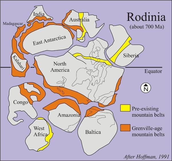
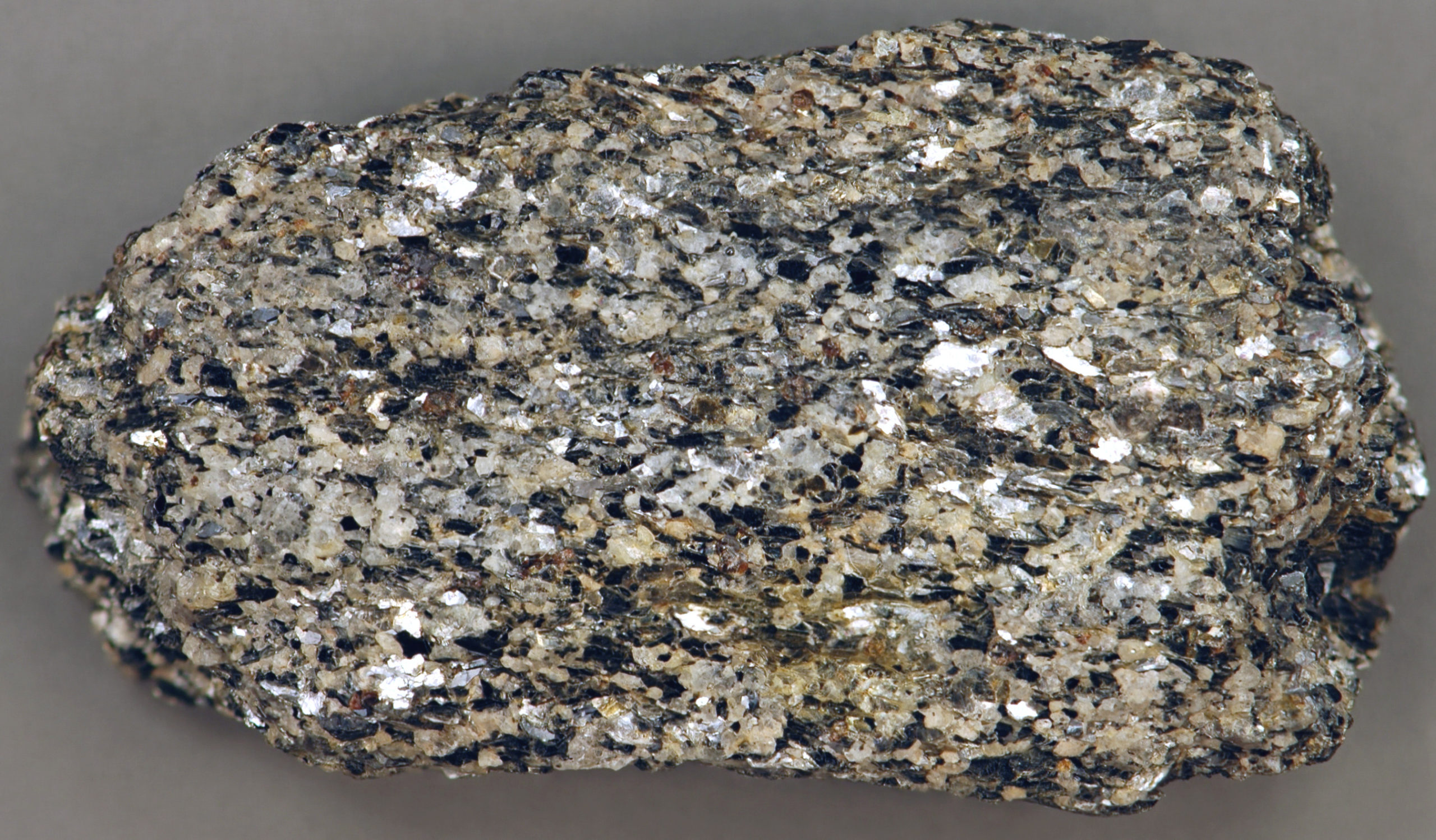
Image: Planet Labs, Inc. / Creative Commons License.
Geologic map and sections of Manhattan Island, 1898. Image: New York Public Library Digital Collection.

Screenshot of linked article web page.

Further Reading

“Skyscrapers seem to dominate Manhattan, but look a little closer and you will see very clearly that they are actually clustered in two distinct areas… The surface bedrock over much of New York City provides solid anchorage to support the high buildings. Although there are two areas of this strong bedrock at or close to the surface, there is a valley in between where the building heights are lower. “

The Manhattan Skyline: Why are there no tall skyscrapers between Midtown and Downtown? by Marcia Anderson, The EPA Blog.

Left arrow (previous post)
Up arrow (back)
Right arrow (next post)

The Manhattan Prong

The Manhattan Prong

The Manhattan Prong was formed approximately 550 million years ago and extended all the way to southwest Connecticut (from the Algonquian Quinnitukqut meaning “at the long tidal river”). Its formation consisted of rolling hills and valleys, controlled by the underlying bedrock. Much of the bedrock was covered by Atlantic Coastal Plain deposits. Metamorphic rocks resistant to erosion comprised the hills, including the Fordham and Yonkers Gneiss, the Lowerre Quartzite, and the Manhattan Schist. The Hudson, Harlem, and East Rivers and the major north-south valleys in (what is now often referred to colonially as) northern Westchester County are all underlain by easily-erodible Inwood Marble formed from the metamorphosing of shallow water marine carbonate and clastic sediment. The formation of Inwood marble extended to the Inwood section of northern Manhattan. The rocks of the Manhattan Prong were tightly folded and metamorphosed primarily during the Taconian Orogeny, about 450 million years ago.

A line drawing showing a cross section of the Hudson River near Newark. Elements of the underlying geologic formations include Manhattan Schist, Inwood Limestone, sandstone, shale, and Fordham Gneiss.
Geology of the Hudson River Gorge, section at George Washington Bridge. Image Credit: illustration by Charles P. Berkey, 1948.
A map of the geology of the lower hudson area of New York State
A geologic map of the Lower Hudson region of New York State.
Image Credit: New York State Museum. Link.
Geological map of a part of southeastern New York showing the distribution of the rocks used as building stones. Image: New York Public Library Digital Collection (Map by Frederick J. H. Merrill, Director of NY State Museum, 1985).
A tabled diagram of the geologic history of New York State.
Diagram of the geologic history of New York State. The rocks of the Manhattan Prong were metamorphosed primarily during the Taconian Orogeny, shown here in the second-last column, third row from the bottom. The Taconian Orogeny was a mountain building period that ended 440 million years ago and affected most of modern-day New England. A great mountain chain formed from eastern Canada down through what is now the Piedmont of the East coast of the United States. As the mountain chain eroded in the Silurian and Devonian periods, sediments from the mountain chain spread throughout the present-day Appalachians and midcontinental North America. Source: Science Teacher Program. Link.

A block of Fordham Gneiss from the east end of Washington Bridge, N. Y. The specimen closely resembles the gneiss of Manhattan Island and is 20 inches across. The area of serpentine is very small and is now inaccessible on account of buildings. It is at Tenth Avenue and West Fifty-eighth Street. The magnesian limestone, or dolomite, occurs in zones in Harlem, where it is now almost covered with buildings, and in the Kingsbridge section of the island, where a good exposure may be seen along the Spuyten Duyvil ship-canal. 

The American Museum journal, 1906. Link.