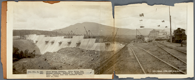
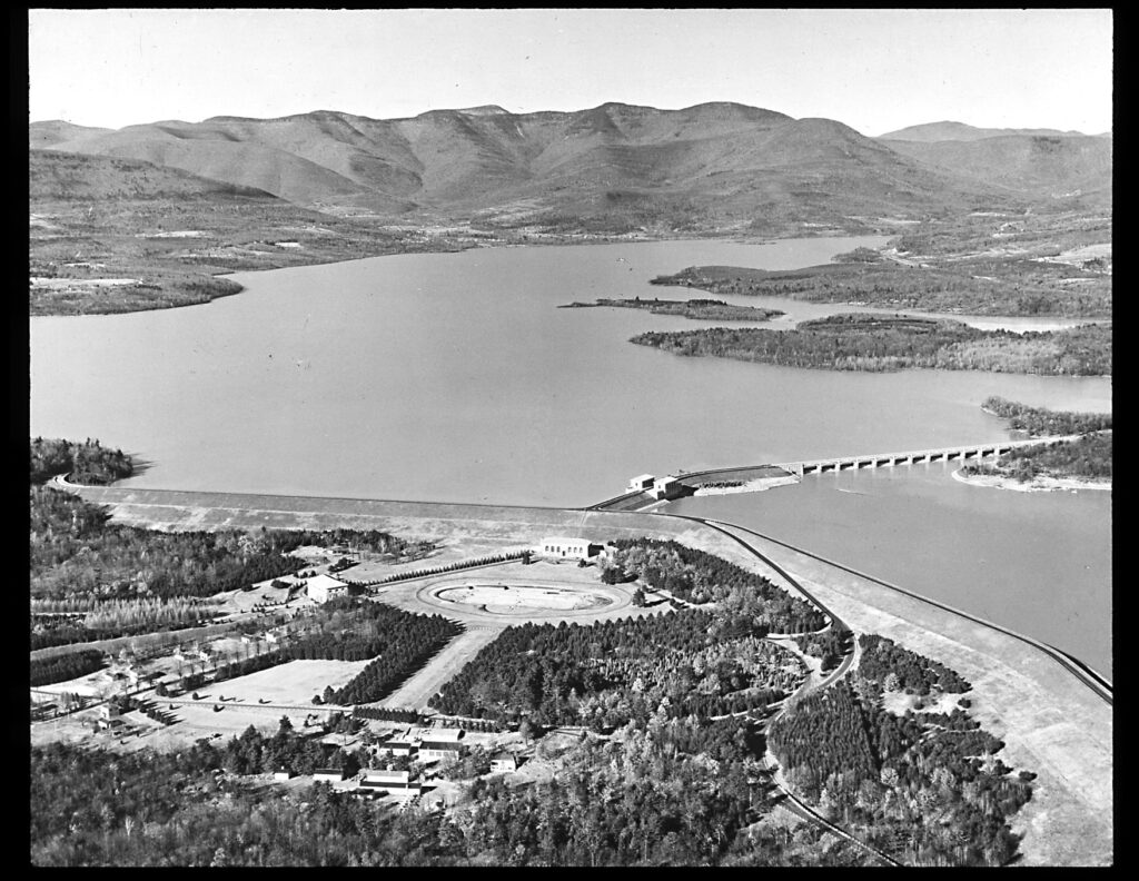
Building The Ashokan Reservoir
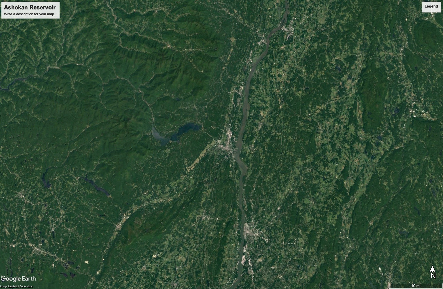
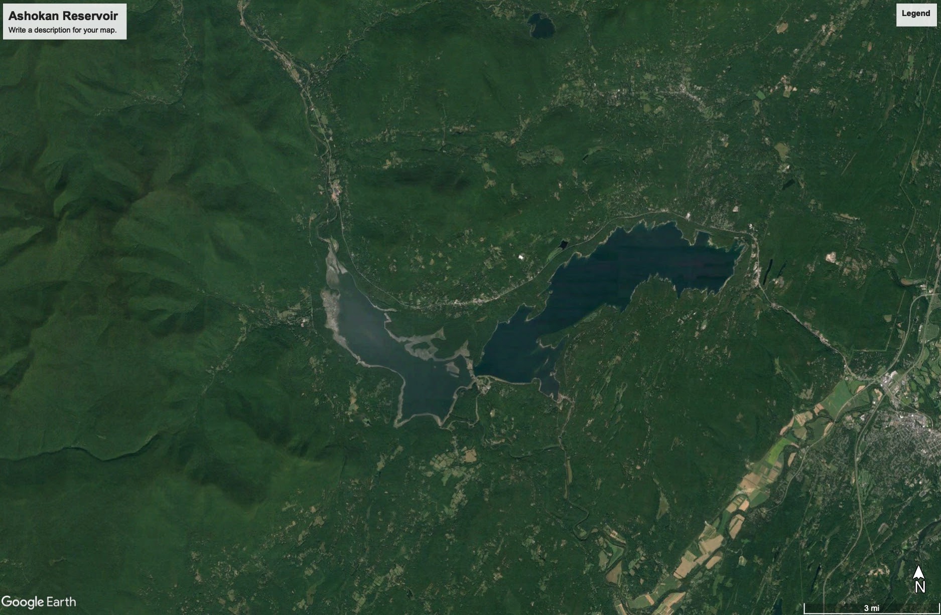
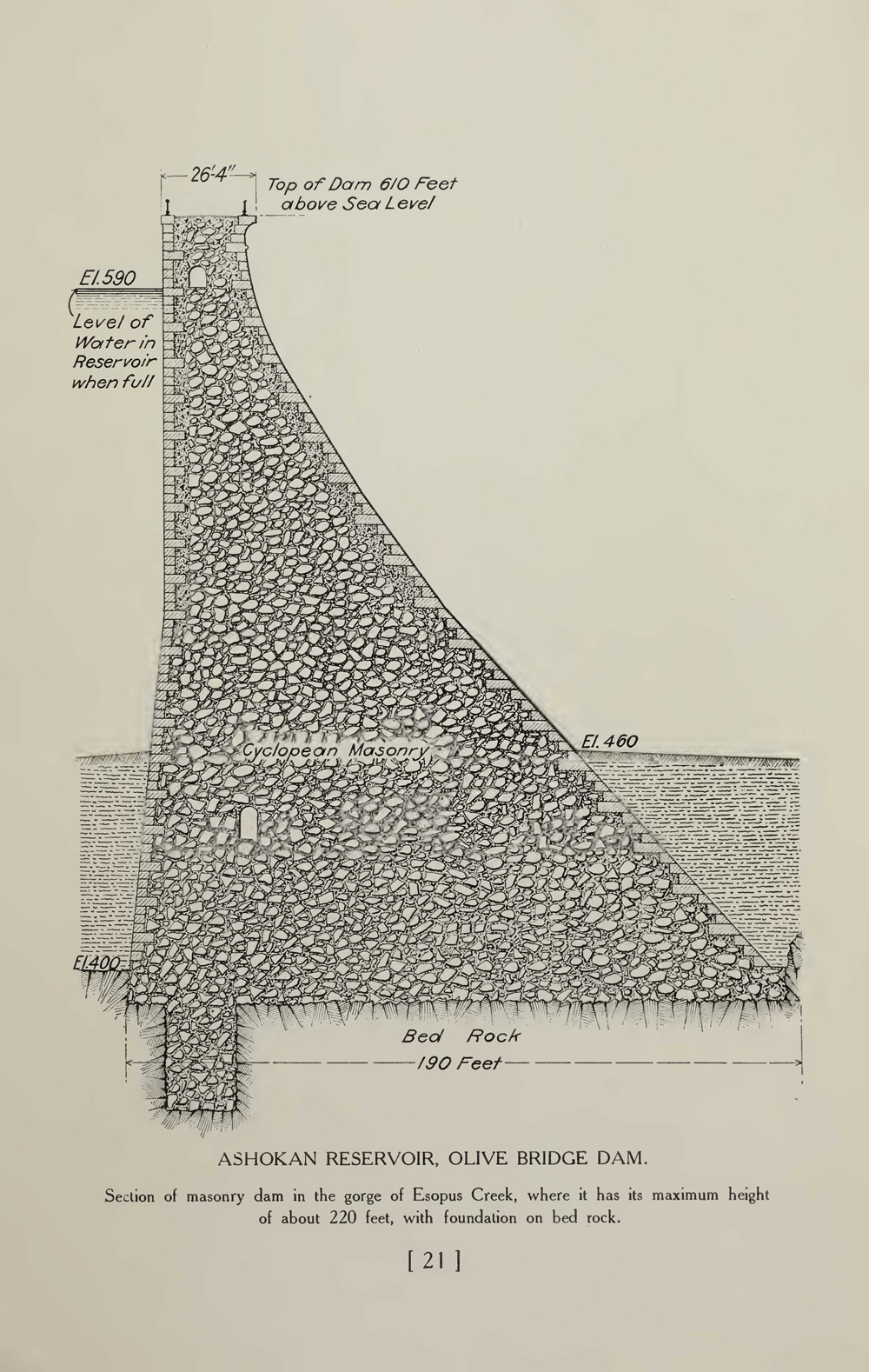
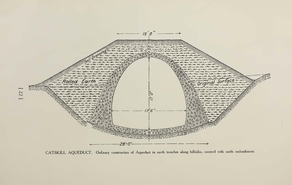
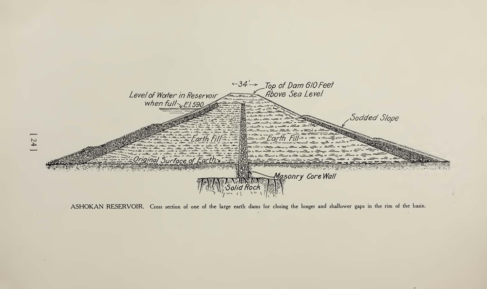
In the Catskills watershed, the Ashokan Reservoir would hold 122.9 billion gallons of water at full capacity and would supply approximately 40% of New York City’s daily drinking water needs in non-drought periods. It was constructed under the auspices of the New York City Board of Water Supply (BWS) beginning in 1907. Its weirs, dikes, and the Olive Bridge Dam backed up Esopus waters for twelve miles, necessitating the removal of homes, farms, businesses, churches, schools and other structures throughout the valley. 2,350 residents were displaced as four hamlets were flooded and eight others were relocated. Many of these residents were not paid the full value of their property and were given two months to uproot their lives and move elsewhere. From the reservoir, water entered into the Catskill Aqueduct and headed south through mountains, over 163 miles of terrain, and under the Hudson River to the Kensico Reservoir in Yonkers, NY, which provided a safety net of two weeks water supply for New York City residents.
![A black and white photo of a landscape dotted with country houses, dilapitated sheds, and in the distance, a church steeple. The photo is taken from up on a hill of a lightly hilled landscape. It is winter as the deciduous trees are bare.](http://public-water.com/wp-content/uploads/2021/03/Ashokan_Reservoir_West_Hurley_1906_NYPL_1000px.jpg)
![A black and white photo of an almost bare valley. There is a creek that cuts through the land and falls with horizontal rock strata embedded in the sides. A couple of houses dot the landscape and a mountain range is barely visible through a haze.](http://public-water.com/wp-content/uploads/2021/03/Ashokan_Reservoir_NYPL_cleared_1913-1024x784.jpg)
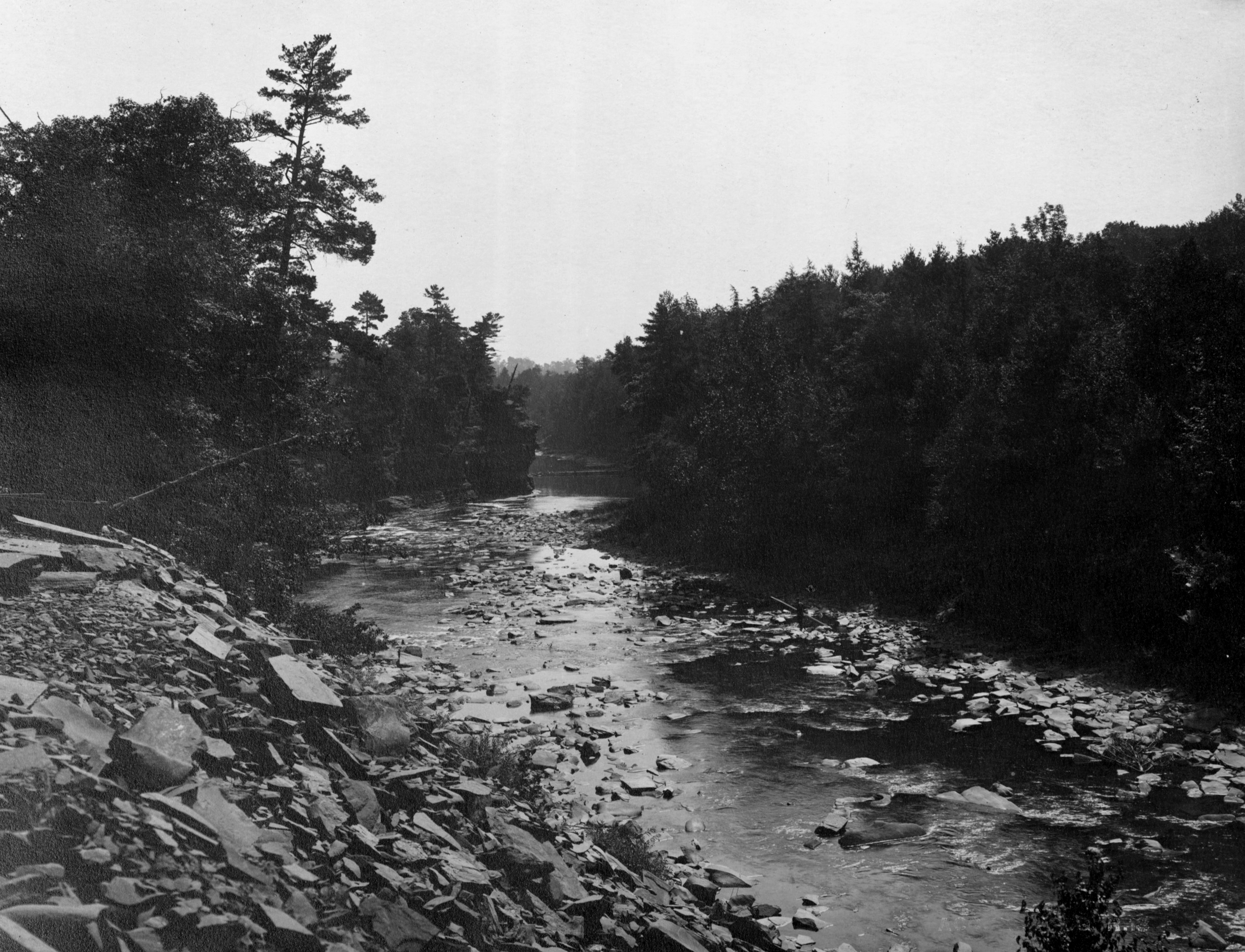
(Above) Here, the land that now forms the basin of the Ashokan reservoir has been cleared, but not flooded. The image above shows the landscape in transition, illustrating the immensity of this project that transformed life and land in parts of the Catskill region.
![A black and white photo during winter time of a two story white house with a wide front porch and two chimneys. There are a few bare trees around and one tall evergreen tree.](http://public-water.com/wp-content/uploads/2021/03/Browns_Station_Jase_Snead_Residence_NYPL.jpg)
![A color photo of a contemporary metal sign that reads "Ashokan Reservoir, Former Site of Shokan". The sign is brown with white lettering and a decorative line in the shape of water ripples across the top.](http://public-water.com/wp-content/uploads/2021/03/Catskills-Ashokan-Reservoir-Former-Site-of-Shokan-Drowned-Towns-NY.jpg)
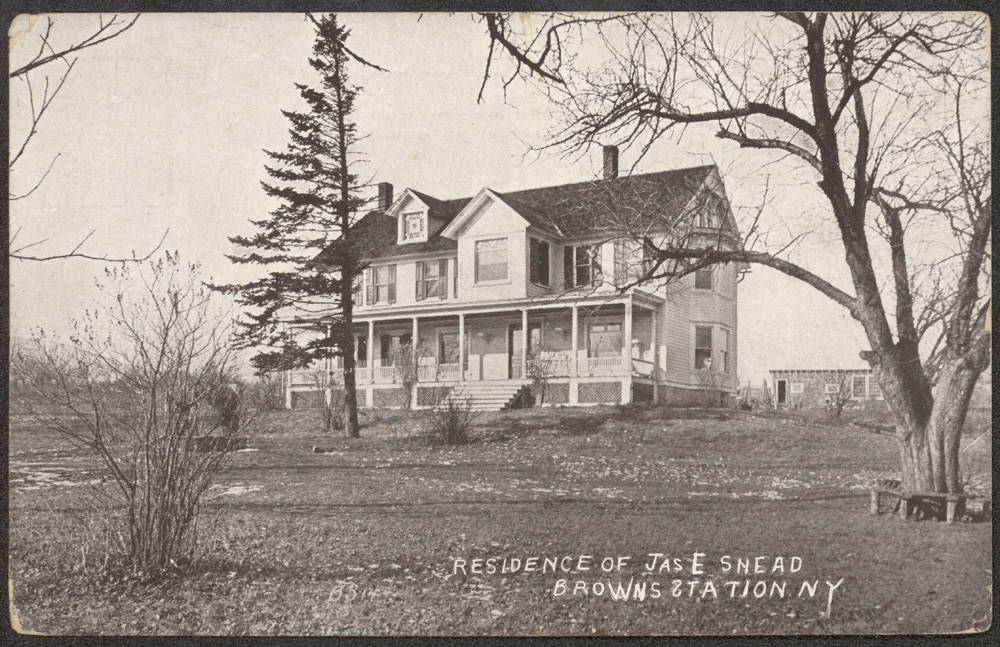
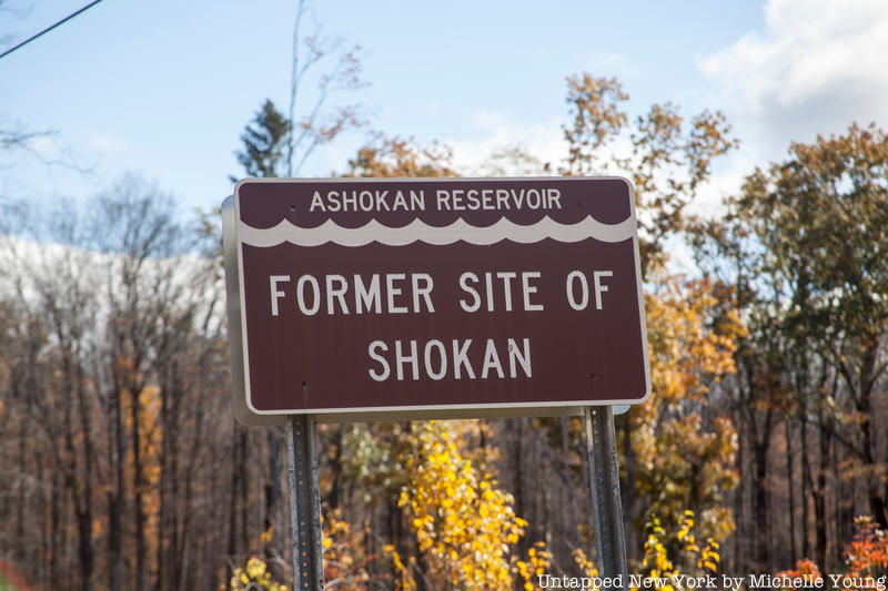
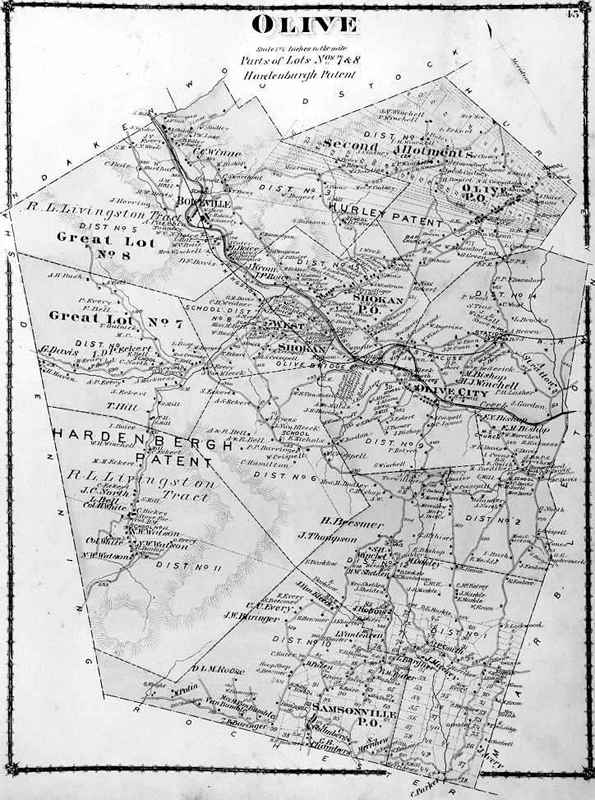
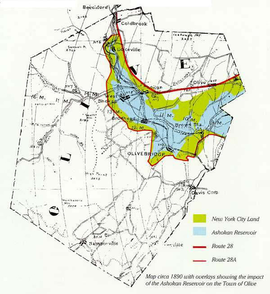
After the construction of the Ashokan reservoir, some towns, like Brown’s Station, Olive City, Broadhead’s Bridge and Ashton, ceased to exist. Others, like the communities of West Hurley, Shokan, West Shokan, and Boiceville, were relocated.
![A black and white map of Olive. The majority of text is unreadable except for a section labeled "Hardenberg Patent" and "Lot 8". The Esopus Creek is a dark line that cuts through the map from left to right.](http://public-water.com/wp-content/uploads/2021/03/town-of-olive-ny-map.jpg)
![A black and white map with a part of the Ashokan Reservoir noted blue over existing land. A ring of green surrounds the reservoir, indicating NYC land..](http://public-water.com/wp-content/uploads/2021/03/1890-map-town-of-olive.jpg)
History provided by the Town of Olive
“Nestled in the Catskill Mountains of New York State is 40,000 acres named the Town of Olive. The Ashokan Reservoir geographically divides Olive–north and south. The hamlets around the shoreline are Boiceville, Olivebridge, Samsonville, Krumville, Shokan, West Shokan, and Ashokan.
The passing of the Water Act of 1905 led to the building of the handmade Ashokan Dam on the Esopus Creek and upon its completion in 1916 created the Ashokan Reservoir, a main water supply for the City of New York-Olive’s largest landowner. The demand for pure, clean drinking water for New York City inhabitants changed the course of history for the Town of Olive and still has an impact on everyday life. The Town center and the majority of the Town’s residents were forced from the rich Esopus Valley and relocated to the nearby foothills. In May of 1997 Land Use Regulations, which could become a model for the rest of the country, became effective as a Memorandum of Agreement was signed between Watershed Towns and the City of New York to provide for protection of water quality throughout the New York City Watershed.”
—Source: Town of Olive website. Link.
![A black and white photo made up of two photos pasted together onto a backing board. The photo is old and has worn and frayed edges. The photo depicts a concrete dam wall under construction in the foreground, and railway tracks on the right foreground. A large mountain is in the background.](http://public-water.com/wp-content/uploads/2021/03/Catskill_Aqueduct_Olive_Bridge_Construction_1911_NYPL.png)
![A black and white photo of a picturesque rocky creek cutting through a forest of evergreen trees.](http://public-water.com/wp-content/uploads/2021/03/Ashokan_Reservoir_Esopus_Creek_1918_NYPL-1024x784.jpg)
In The Catskills: It’s History and How It Changed America, authors Stephen M. Silverman and Raphael D. Silver quote a report on the opening of the Ashokan reservoir in Hudson Valley Magazine: “Improbably, miraculously, a tiny creek originating high in the Catskill Mountains had been successfully damned to create a thirteen-square-mile drinking fountain for city folk.”
![A black and white schematic drawing of engineering plans for a dam wall. It is a cut-away view of a tunnel and the surrounding earth.](http://public-water.com/wp-content/uploads/2021/03/NYC_Board_of_Water_Supply_Inauguration_Report_1907_IA_Page_24.jpg)
![A black and white schematic drawing of engineering plans for one of the large earth dams for closing the longer and shallower gaps in the rim of the basin. It looks like a triangular volcano like shape with a masonry core wall in the middle.](http://public-water.com/wp-content/uploads/2021/03/NYC_Board_of_Water_Supply_Inauguration_Report_1907_IA_Page_26.jpg)
Source: Library of the University of Illinois College of Engineering via Internet Archive. Link.
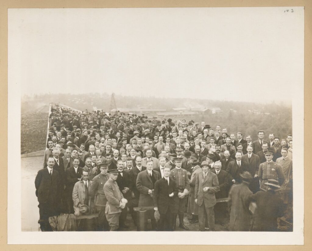
“On October 11, Acting Mayor Ardolph Kline presided over a special luncheon attended by 500 engineers, officials and invited guests who also toured the dam site and reservoir, a reservoir whose name may be derived from the Indian word “sokan,” meaning “to cross the creek.”
— Liquid Assets by Diane Galusha.
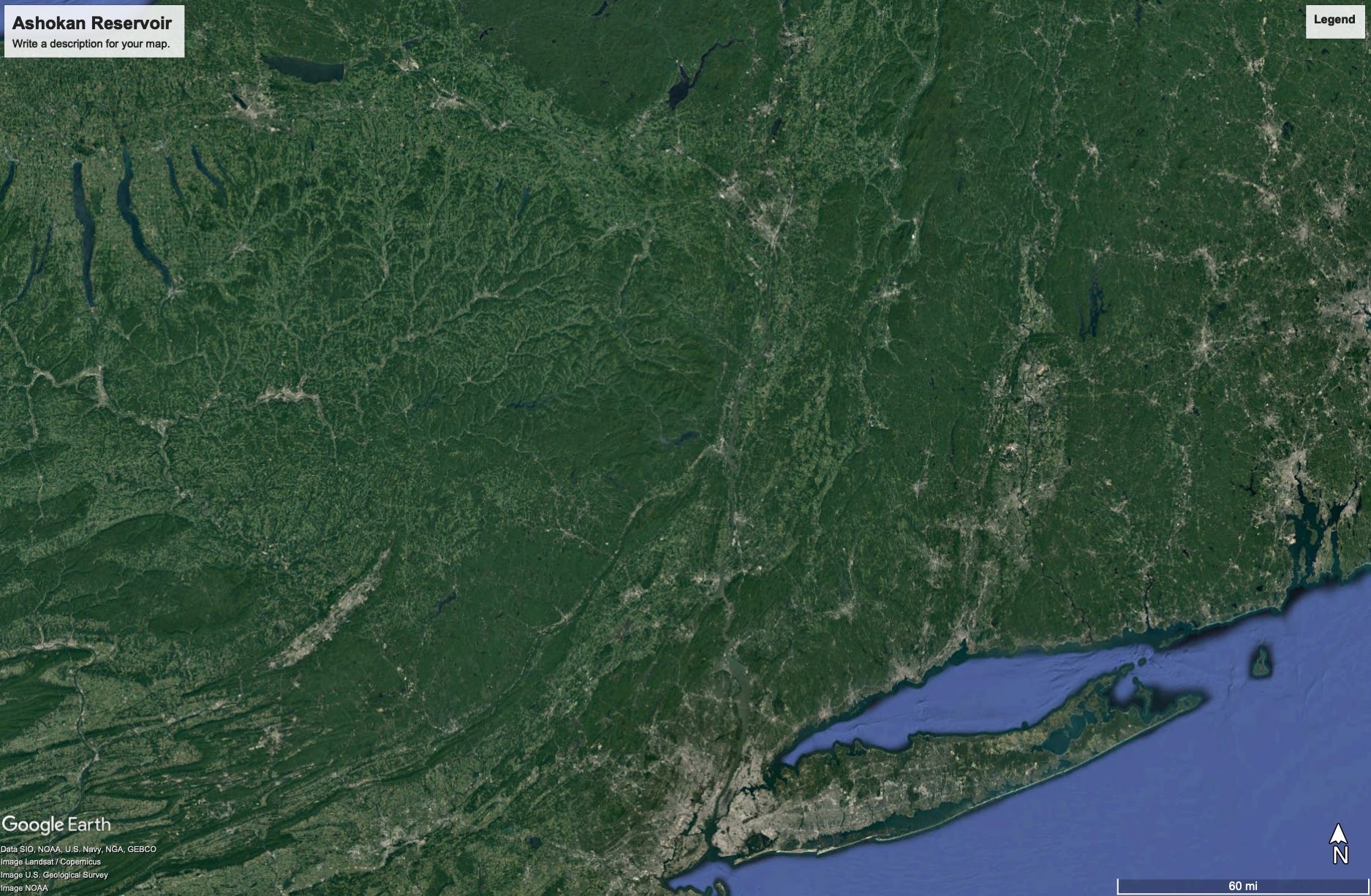
![A black and white photo of a large crowd of white men on a bridge looking at the camera which is up high. Some buildings can be seen in the distance.](http://public-water.com/wp-content/uploads/2021/03/Ashokan_Olive_Dam_Visitors_1913_NYPL-1024x824.jpg)
![A bird's eye aerial black and white photo of the Ashokan Reservoir with a mountain range in the background. The body of water in the middle, and man-made circular structure and landscaped features in the foreground. A bridge stretches across from the foreground land to another edge of the water on the right.](http://public-water.com/wp-content/uploads/2021/03/Ashokan_Reservoir_Aerial_1933-1024x792.jpg)