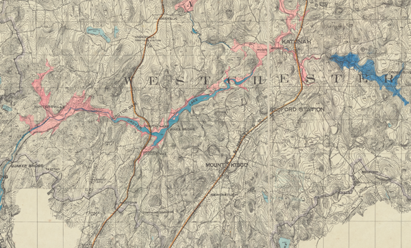
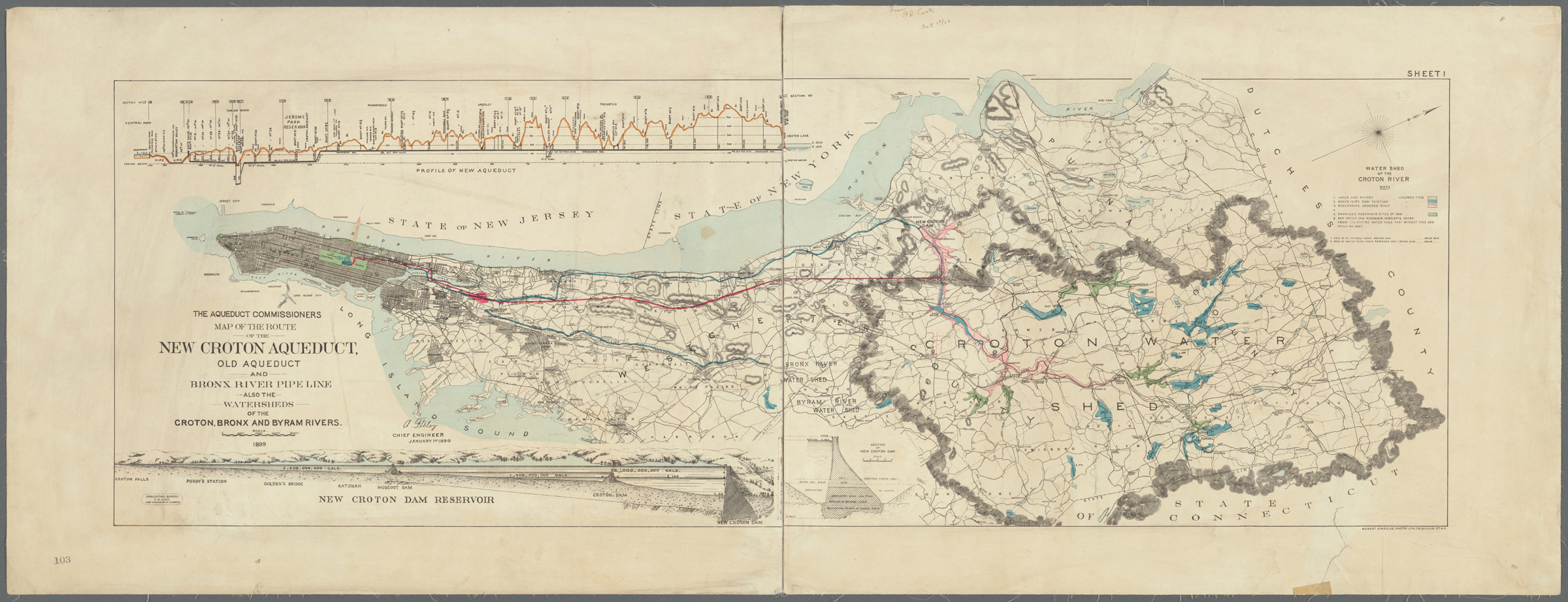
The New Croton Reservoir
By 1906, the aqueduct commission had completed the New Croton Dam which expanded the existing Old Croton Reservoir to include the sprawling New Croton Reservoir, the centerpiece of the Croton network. New York added two more reservoirs over the next several years, finally completing the water system that had begun construction in 1837. The Croton project developed supporters in the budding Westchester County suburbs and nearby communities because they would be able to tap into the water system for their own use. However, it came with many struggles for other Westchester residents. New York City did not pay taxes and often abused farmers and their property, including burning their houses and barns. Going forward, this would be the extent of New York City’s ability to build in Westchester County due to restrictions instigated by Westchester and Dutchess County citizens and put in place by state officials.
![A cropped topographic map of Westchester and the Croton Dam. Towns noted on the map are Mount Kisco, Newcastle, and Pines Bridge. The New Aqueduct is indicated in a dotted line adjoined to the Croton Dam striking southwards. Croton Lake is color coded in blue, and surrounded with a larger pink shaded area, noting the newer Croton Reservoir that will be constructed around it.](http://public-water.com/wp-content/uploads/2021/01/Map_Croton_Watershed_1889_vertical2-645x1024.jpg)
![A contemporary computer designed map of the lower Hudson Valley showing the Manhattan Prong, Westchester, New Jersey, Brooklyn, Connecticut, and Long Island. A blue line hooks its way from the Croton Lake and Croton Dam down south along the Hudson River and into Manhattan to the receiving reservoir and the Croton Distributing Reservoir in the Bronx.](http://public-water.com/wp-content/uploads/2021/01/New_Croton-aqueduct-1024x930.png)
![A map of the Croton Watershed with the Hudson River indicated on the left, running top to bottom (North to South), and the Watershed marked in a dark green against a lighter green. Its shape resembles a tree with a robust top, narrowing down into a short stump. Bodies of water are dotted in the watershed marked in dark blue. A corner of the Long Island Sound is wedged in the bottom right corner. Aqueduct lines are drawn moving through the watershed.](http://public-water.com/wp-content/uploads/2021/01/NYC_EP_Map_Croton_Watershed_Current-791x1024.jpg)
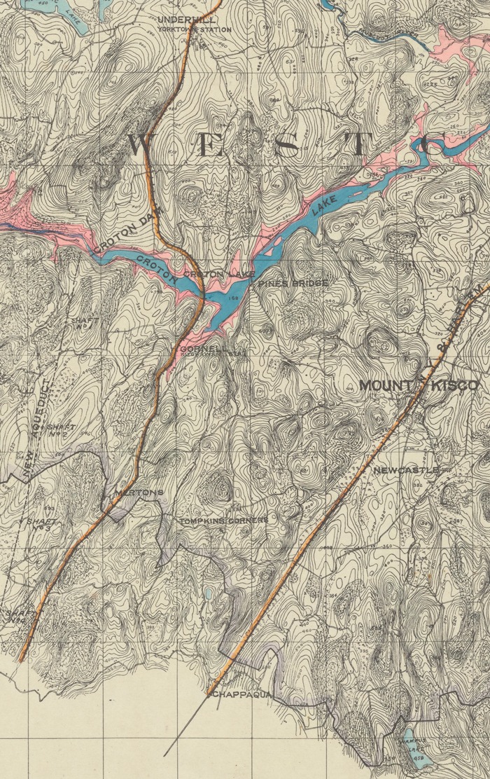
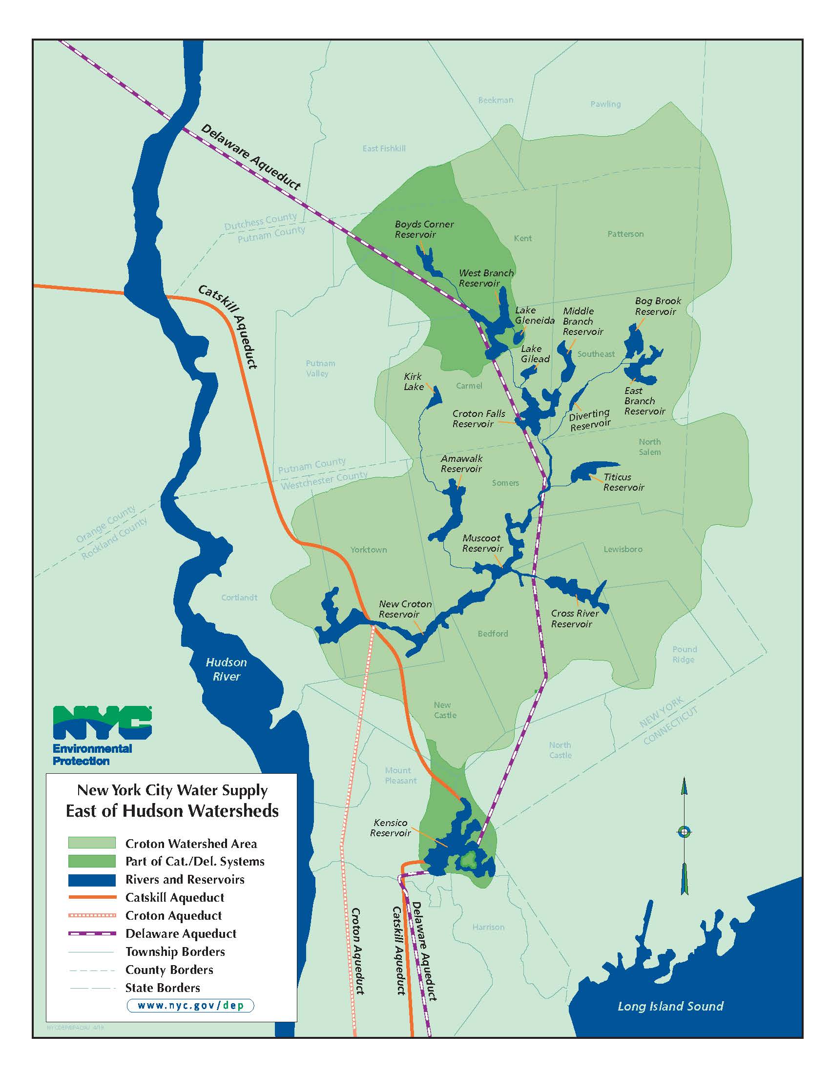
After the opening of the first Croton aqueduct demand for water in NYC only grew. Throughout the second half of the 19th Century (i.e. even before the construction of the New Croton Reservoir, Muscoot, Cross River, Croton Falls, and expanded Kensico Reservoir, and before the expansion to the Catskills) the City took measures to expand the water supply. This included the construction of the New Croton Aqueduct, which had a greater carrying capacity than the original tunnel. Between 1860 and 1895, the City constructed the second Central Park Reservoir (now called the Jackie Kennedy Onassis Reservoir), initial dams for the Boyds Corner and Kensico Reservoirs (later expanded), and the East Branch, Middle Branch West Branch, Bog Brook, and Titicus Reservoirs.
![A horizontal map of New York City (Manhattan and the Bronx) and Westchester showing the Croton Watershed. There is an outline around the watershed area and bodies of water colored blue and pink (for future construction). There are three colored lines denoting aqueducts running from Westchester to Manhattan, the old Croton aqueduct, the new aqueduct, and the Bronx River pipeline.](http://public-water.com/wp-content/uploads/2021/01/New_Croton_Aqueduct_map_2400px-1024x393.jpg)
![A black and white technical drawing of the New Croton Dam. It shows a side elevation of the dam wall with an arched bridge to the left.](http://public-water.com/wp-content/uploads/2021/01/Aqueduct_Commission_1907_Plan_Downstream_Elevation_LOC_2-1024x319.png)
![A black and white technical drawing of the New Croton Dam. It is an overhead view that focuses on the public roadway over the bridge that runs horizontally across the paper, leading to the gatehouse. The aqueduct lines are indicated on the right running top to bottom.](http://public-water.com/wp-content/uploads/2021/01/Aqueduct_Commission_1907_Plan_Croton_Dam_LOC_2-1024x303.png)
![A color photograph made with a large format 4x5 camera (with black frame lines bordering the image) of the New Croton Reservoir and Dam. The view is similar to the previous photos but the camera is lower, on the same level as the top of the bridge, looking down to the waterfall.](http://public-water.com/wp-content/uploads/2021/01/New_Croton_Dam_Reservoir_3_LOC.jpg)
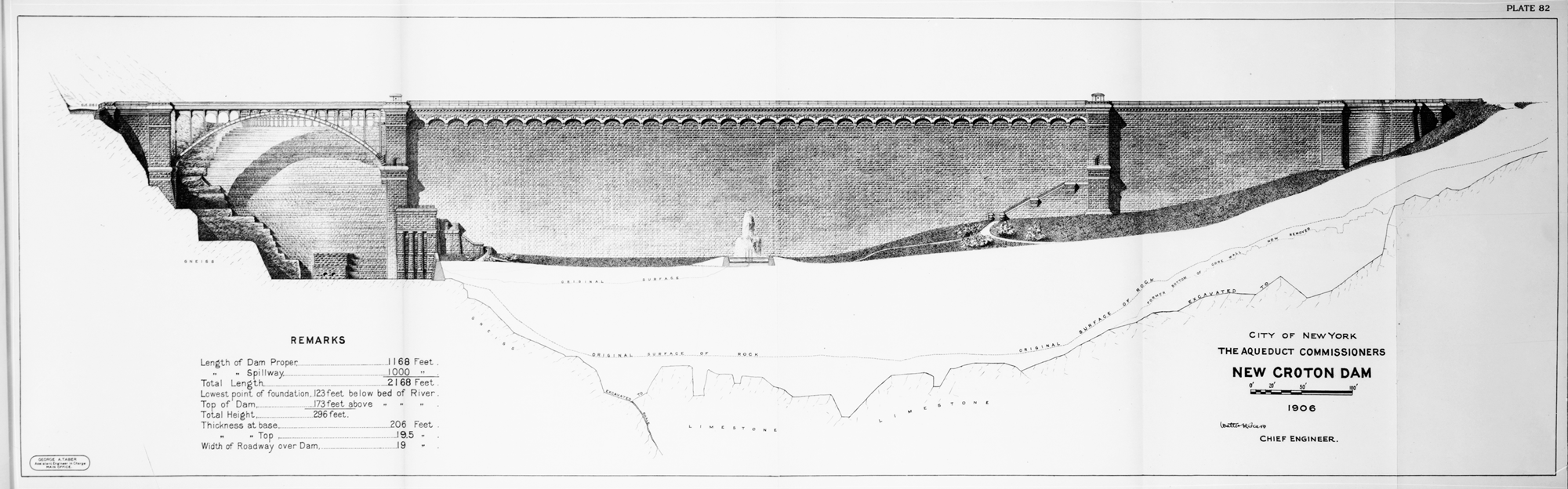
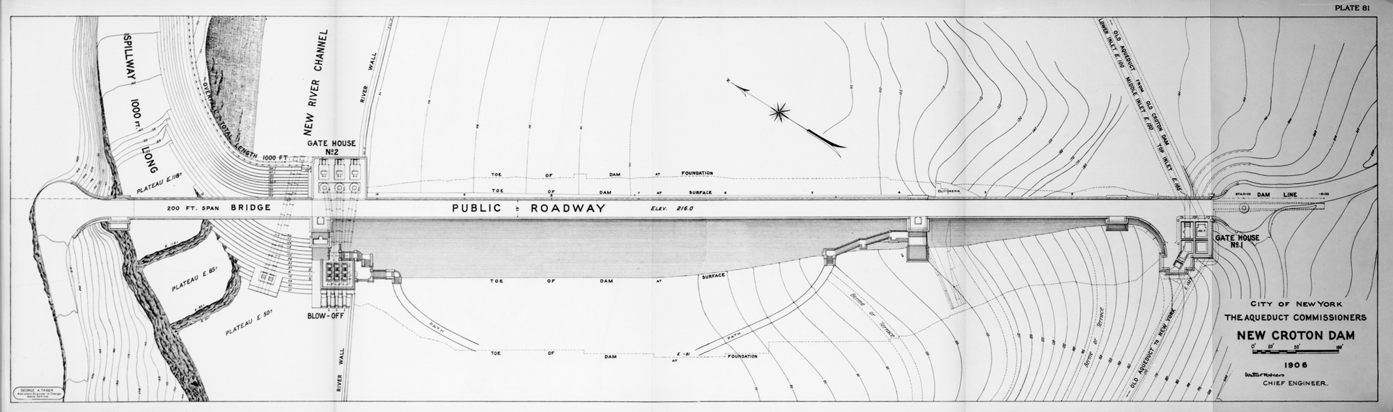
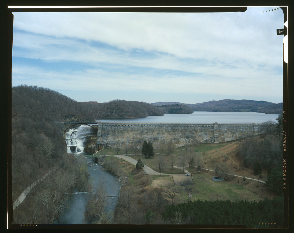
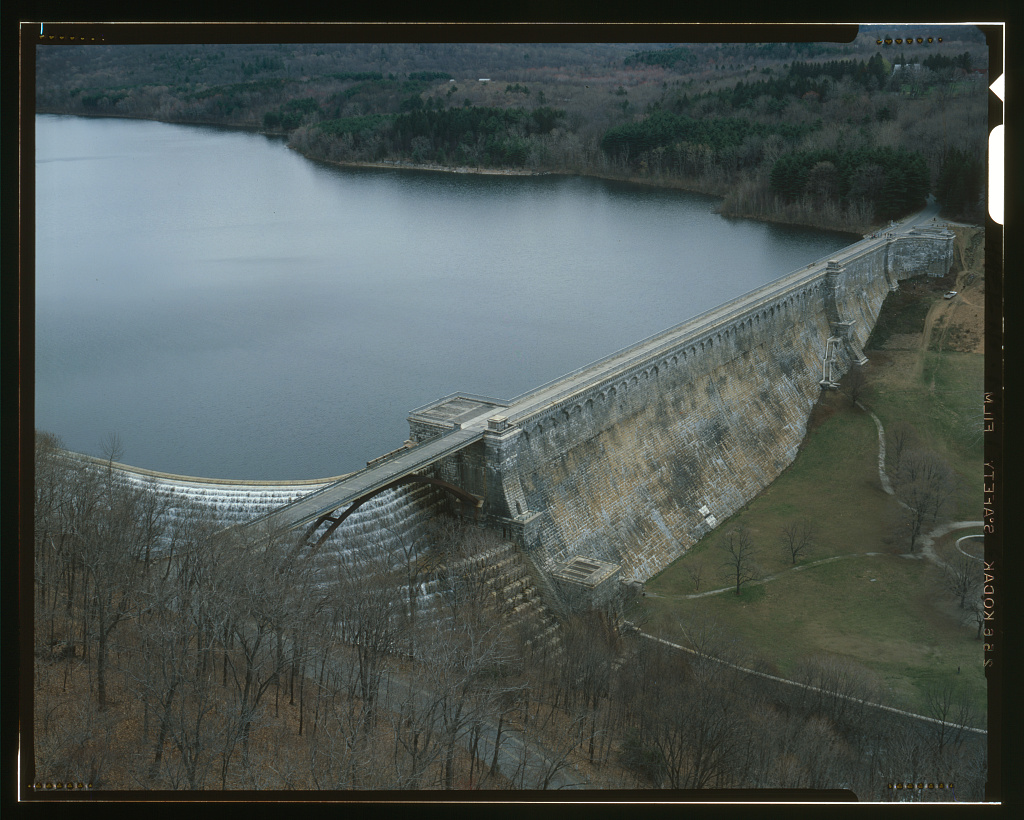
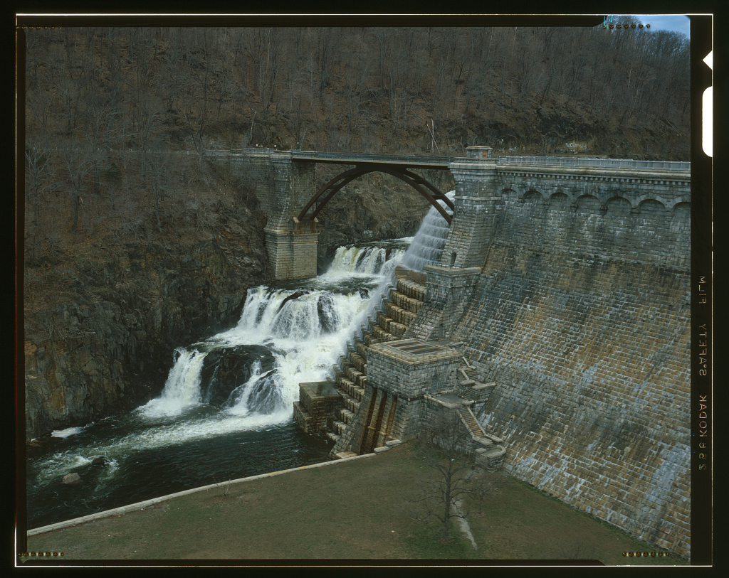
“Expected to take five years, the dam’s construction faced a number of challenges, including a violent labor strike in 1900 and the 1901 condemnation and subsequent masonry replacement of the dam’s earthen embankments. After fourteen years of construction, the dam was ultimately successful and, at 301 feet high and 2400 feet long, was the largest dam in the world at the time. In the following few decades, the dam was a popular tourist destination; today, as the largest hewn-stone structure in the United States, it remains the focal point of Croton Gorge Park.”
— Croton Waterworks website
![An old photograph tinted amber and black. It depicts the construction zone of the Croton Dam wall in the background with hills and trees, cranes, and factories in front of the wall. In the foreground is a man dressed in black wearing a bowler hat and carrying an umbrella. He is looking at the camera. Etched into the negative is child-like handwriting that says "This is Mr. John Fish at Croton Dam"](http://public-water.com/wp-content/uploads/2021/01/John_Fish_New_Croton_Dam_crotonhistory-1024x748.jpg)
![An amber-tinted photograph looking down on a bare dirt valley. A partially-built dam wall surrounds the area where there is an area of water, a house, a shack and railroad lines. Text is stamped into the photo that says "As the valley looks now - empty"](http://public-water.com/wp-content/uploads/2021/01/Croton_Dam_empty_Valley-1024x756.jpg)
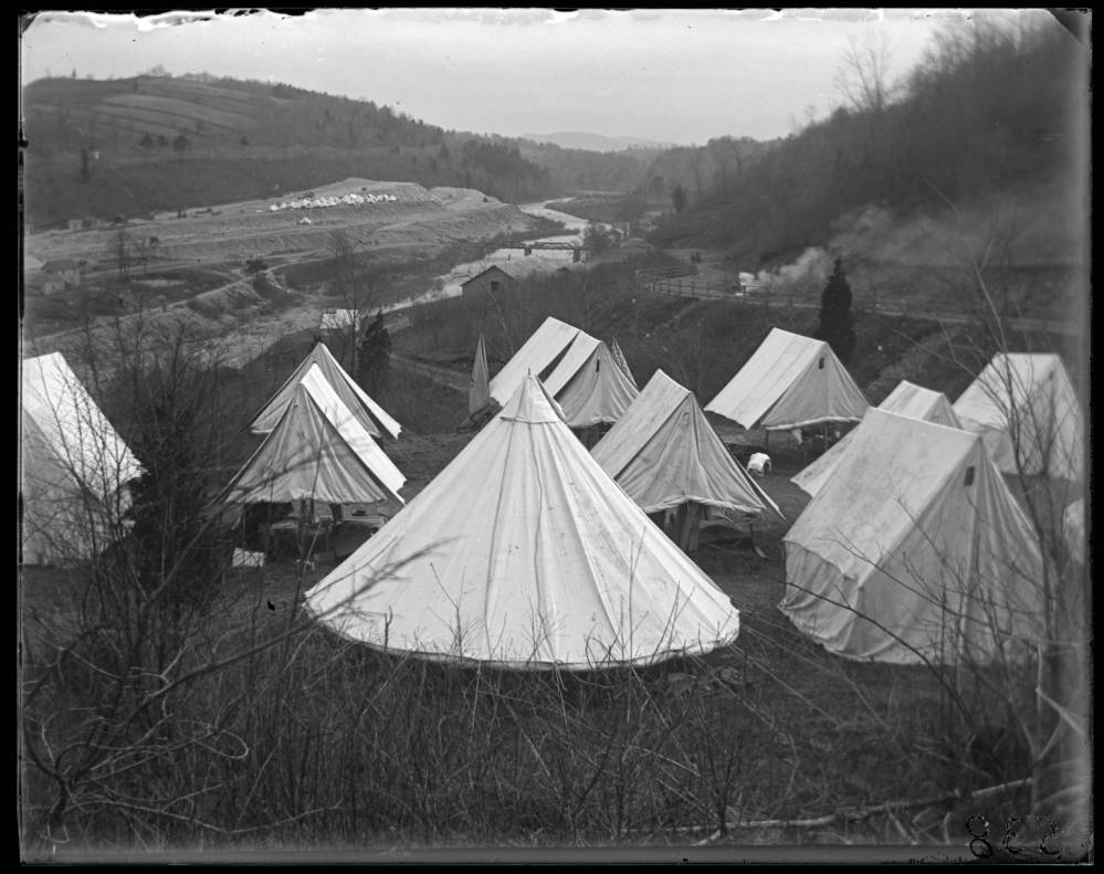
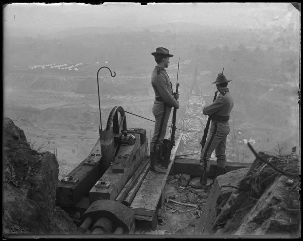
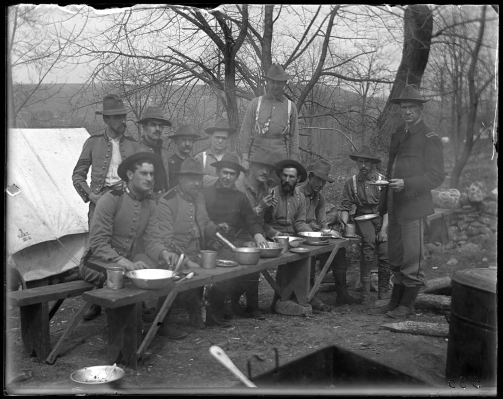
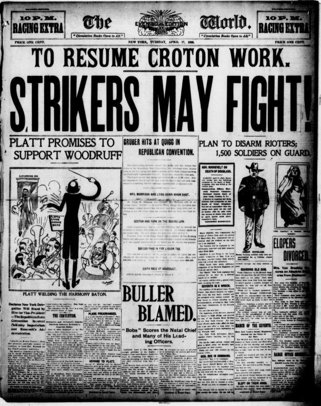
Labor Strike and the National Guard Intervention
In 1900, the work force constructing the dam—made up of primarily Italian immigrants as well as Irish immigrants and African Americans—went on strike to protest unfair wages. The workers were paid under the prevailing wage for incredibly hard and dangerous work. The NY State National Guard was called in to protect replacement workers and so ensued violent responses.
![A black and white photo looking down from a hilltop to the valley below. The dam wall is under construction with crane-like steel armatures sitting atop a half-built wall that extends from camera left down into the valley. On the distant hillsides on the otherside of the valley there are lines of teepee-like tents. It is winter, with bare trees visible on the far hills.](http://public-water.com/wp-content/uploads/2021/01/Croton_Dam_strike_1900_construction.jpg)
![A black and white photograph of the valley where the dam was being constructed. A cluster of white canvas tents occupy the foreground. In the background there is the dam construction and more tents. Another cluster of tents is seen in the far background, and further in the view are distant hazy hills.](http://public-water.com/wp-content/uploads/2021/01/Croton_Dam_Strike_1900_tents.jpg)
![A black and white photo of two soldiers with rifles looking over a cliff into a foggy valley where the dam is being constructed. There is a tent village down in the valley and distant hills. The soldiers are standing near a crane wheel with a cable that drops down off the cliff edge down into the valley below.](http://public-water.com/wp-content/uploads/2021/01/Croton_Dam_Strike_1900_soldiers.jpg)
![A black and white photograph of a group of soldiers sitting on a bench, some standing behind. They are sitting in a camp with bare trees and tents. Silverware, plates and bowls are set on a bench in front of the soldiers.](http://public-water.com/wp-content/uploads/2021/01/Croton_Dam_Strike_1900_soldiers_dinner.jpg)