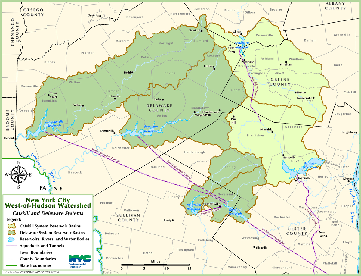
Tapping the Delaware River
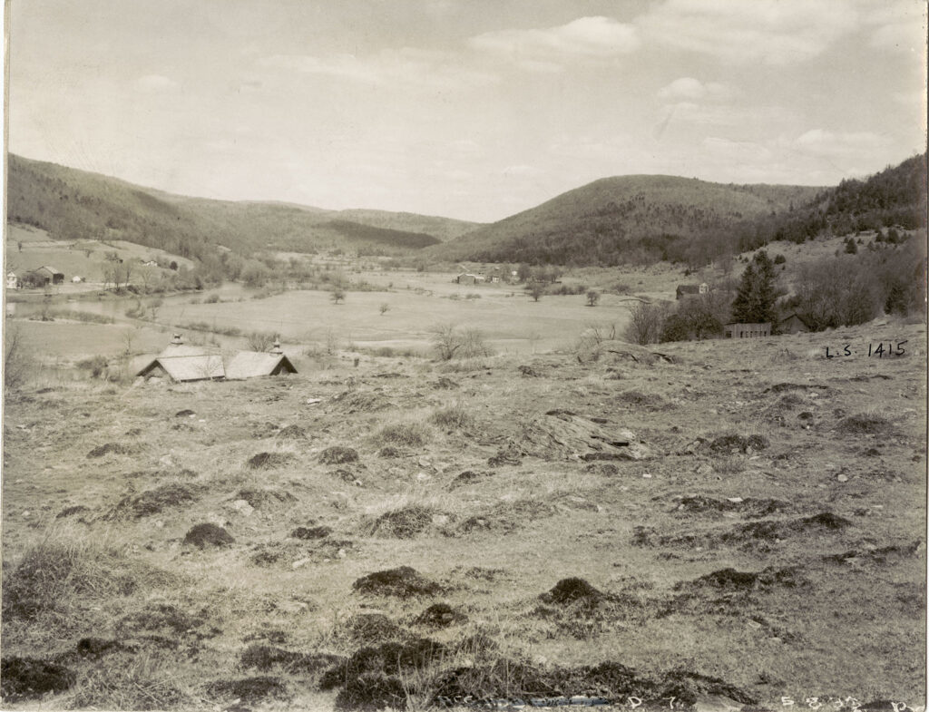
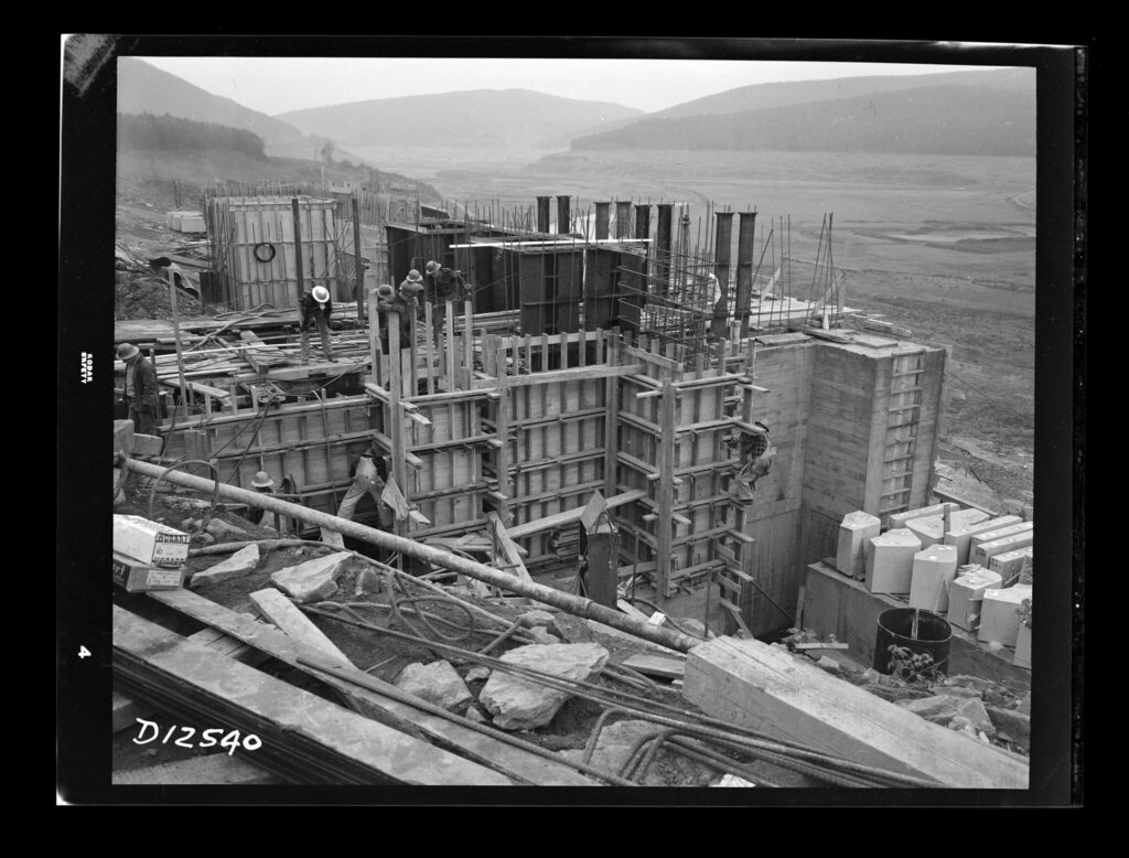
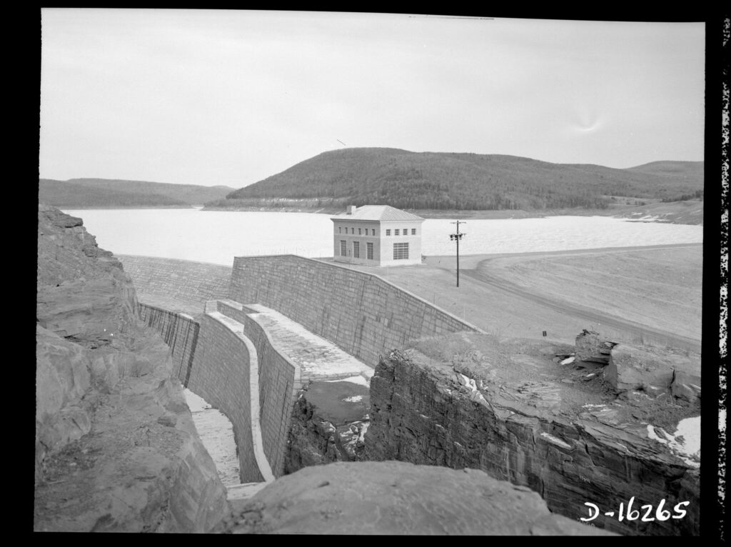
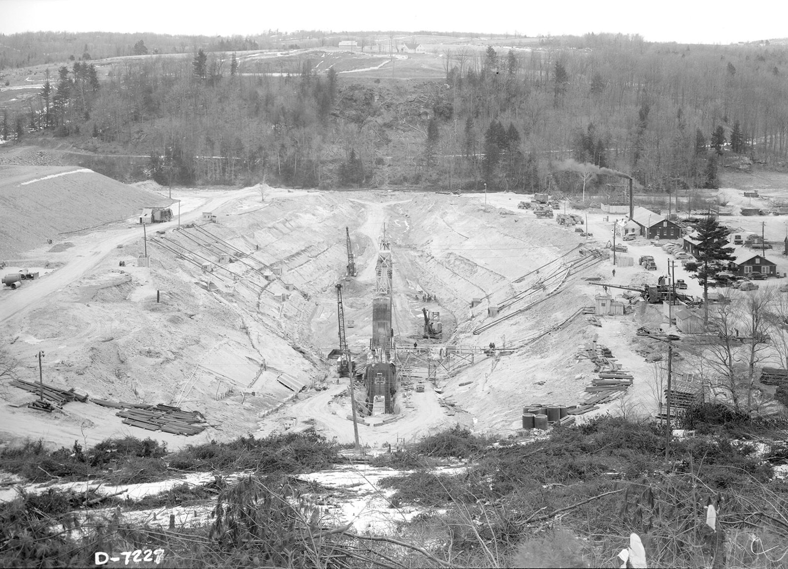
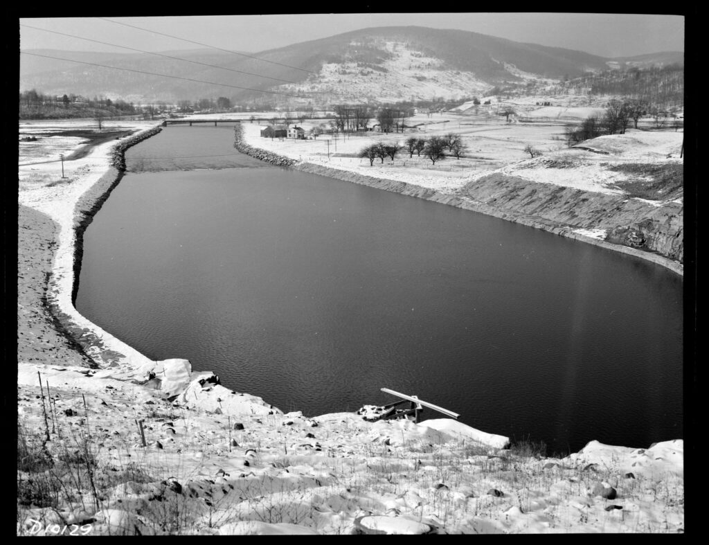
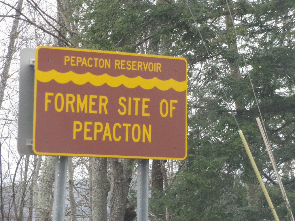
After the Supreme Court ruling, New York City built four new reservoirs. Bounded by Ulster and Sullivan County, the Rondout Reservoir commenced building in 1937 and was in service by 1951. The communities of Eureka, Lackawack, and Montela were flooded. The Neversink Reservoir in Sullivan County was completed in 1953, and the hamlets of Neversink and Bittersweet were flooded. The city acquired more than 13,000 acres for the Pepacton Reservoir in Delaware County, which was completed in 1954. The 2,400-foot-long dam enclosed the largest of the reservoirs at eighteen miles long. The Pepacton displaced 974 people in the communities of Arena, Pepacton, Shavertown and Union Grove. Another Supreme Court case allowed the city to take additional water from the Delaware River. So, in 1965 the Cannonsville Reservoir was built and completed the Catskill/Delaware water system. This reservoir displaced an additional 941 people with the flooding of five more communities: Beerston, Cannonsville, Granton, Rock Royal, and Rock Rift.
![A contemporary map of the West of Hudson watersheds, aqueducts, and reservoirs. The Delaware watershed is shaded green and touches the Delaware River on the right, close to the PA/NY border.](http://public-water.com/wp-content/uploads/2021/04/West-of-hudson-map_fromCWC-1024x782.jpg)
![An old illustrated map of Delaware County bordered with drawings of historic or important buildings and homes and enlarged maps of some of the towns.](http://public-water.com/wp-content/uploads/2021/04/Map_of_Delaware-County_1856_LOC_sml-1024x1012.jpg)
![A black and white photo taken from the base of a valley with sloping mountains in the background. In the foreground is farmland and three houses scattered in the landscape.](http://public-water.com/wp-content/uploads/2021/04/Donsville_Dam_Site_NYCW-1024x785.jpg)
![A black and white photo of a construction site on the side of a hill looking down on an empty valley. There are structures being prepped to pour concrete into.](http://public-water.com/wp-content/uploads/2021/04/E_Delaware_Tunnel_Intake_Chamber_NYCW-1024x778.jpg)
![A black and white photo of rocky cliffs in the foreground surrounding a dam wall and brick building that overlooks the reservoir. In the background sits a mountainous horizon.](http://public-water.com/wp-content/uploads/2021/04/E_Delaware_Release_Chamber_NYCW-1024x766.jpg)
“Most residents found themselves on a one-way street. Even those hired to help construct the water system felt outgunned by the arsenal of a city whose needs far outweighed their own. “People were angry with the city and they had to give up their land,” said Bob Steuding, “but it was also a source of revenue for them.””
— From The Catskills: Its History and How It Changed America by Stephen M. Silverman and Raphael D. Silver
![Two newspaper clippings. The left is a dark photo of a man standing in a workshop. The headline reads "A forge soon to be quenched" and the small type below mentions Mr. Evans who was Lackawack's blacksmith. His forge "was soon to be swept into the limbo of things that were, when New York City takes over that village as a reservoir site." The other clipping is headed "Awaiting the Flood Waters" the photo features a old man and woman with the man reading a book and the woman at a yarn wheel. The caption highlights that these are one of the scores of homes that laborers will soon destroy.](http://public-water.com/wp-content/uploads/2021/04/Displacement_Lackawack_1936.jpg)
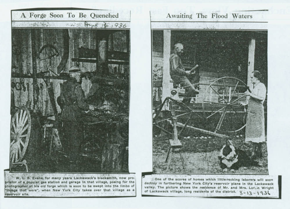
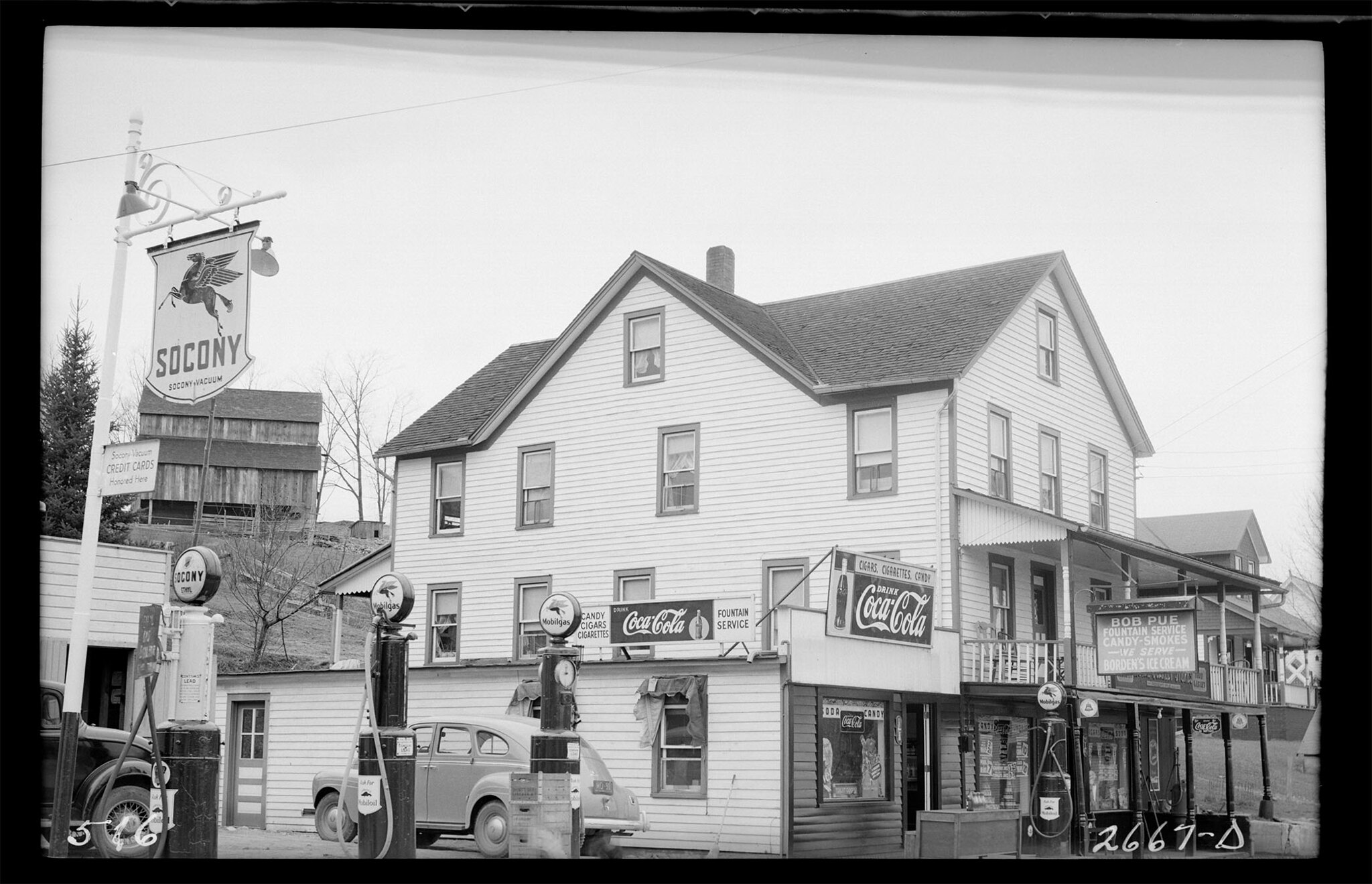
The residents of Eureka, NY were displaced to make way for the Rondout Reservoir.
![A black and white photo of a class of children and their teacher standing in front of a wood building.](http://public-water.com/wp-content/uploads/2021/04/Ellensville_Eureka_School_Students_NYCH.jpg)
“Dislocation was only the beginning. For years New York City refused to acknowledge that the dams were taxable improvements and paid taxes only on the amount of unimproved lands it owned around the reservoirs. Local citizens felt violated, aware that there were few other places in the country where a government, unresponsive to the electorate, could impose such dramatic changes on a region’s way of life.”
— From The Catskills: Its History and How It Changed America by Stephen M. Silverman and Raphael D. Silver
![A black and white photo of a rivers edge with a group of boys in and out of the water.](http://public-water.com/wp-content/uploads/2021/04/Neversink_River_Swimming_NYCW-1024x755.jpg)
![A black and white photo of a white three story wood building with gas pumps outside and coca cola advertisement signs affixed to the outside of the building.](http://public-water.com/wp-content/uploads/2021/04/Neversink_NY_Gas_Pump_NYCW-1024x660.jpg)
![A black and white photo looking down onto an excavation site. It looks like a slit in the earth has been cut.](http://public-water.com/wp-content/uploads/2021/04/Neversink_Dam_Excavation_NYCWater-1024x739.jpg)
“Neversink Reservoir: Completed in 1955 to provide water for New York City. The Neversink River, flowing through the valley, was a great attraction for trout fisherman and flytiers. This Valley was settled over 200 years ago. [The] Villages of Neversink and Bittersweet lie beneath these waters. There were farms, a sawmill, a casino, a bowling alley, general stores, boarding houses, churches, schools and more here.”
— Text from a plaque at Neversink Reservoir (Link)
“I’ll never forget having to witness my grandmother… a quilter, and grandfather… crippled with arthritis, walk away from their home as it was being bulldozed, waiting for the gasoline to be poured on it and then burned.”
— Evelyn Norris, granddaughter of H.V. and Anna Dumond who lived in Union Grove, one of the towns flooded for the Pepacton Reservoir, which came into service in 1954. (Norris quoted in The Catskills)
![A panoramic photo made of three black and white photos pieced together. The camera is looking down into the valley under construction. The valley construction spreads way into the background on the left, surrounded by mountain ranges off in the distance.](http://public-water.com/wp-content/uploads/2021/04/Construction_Pepacton_Res_Downsville_Dam_NYCW-1024x326.jpg)
![A black and white photo taken inside of a tunnel under construction with workers posing on four stories of scaffolding.](http://public-water.com/wp-content/uploads/2021/04/Pepacton_Diversion_Tunnel_Drill_Crew_NYCW-1024x758.jpg)
![A black and white photo of a group of workers in hard hats against a dark background. Four are in a steel tub attached at the top to a crane hook.](http://public-water.com/wp-content/uploads/2021/04/Holing_Through_Pepacton_NYCW-1024x811.jpg)
![A black and white photo taken from high up on a hill looking down on a large, deeply dark body of water. Mountains loom in the background.](http://public-water.com/wp-content/uploads/2021/04/Pepacton_Reservoir_NYCWater-1024x787.jpg)
![A color photo of a road sign that reads "Pepaction Reseroir, Former site of Pepacton" The sign is brown with yellow writing and a decorative wave border.](http://public-water.com/wp-content/uploads/2021/04/Pepacton_former-site_sign.jpeg)
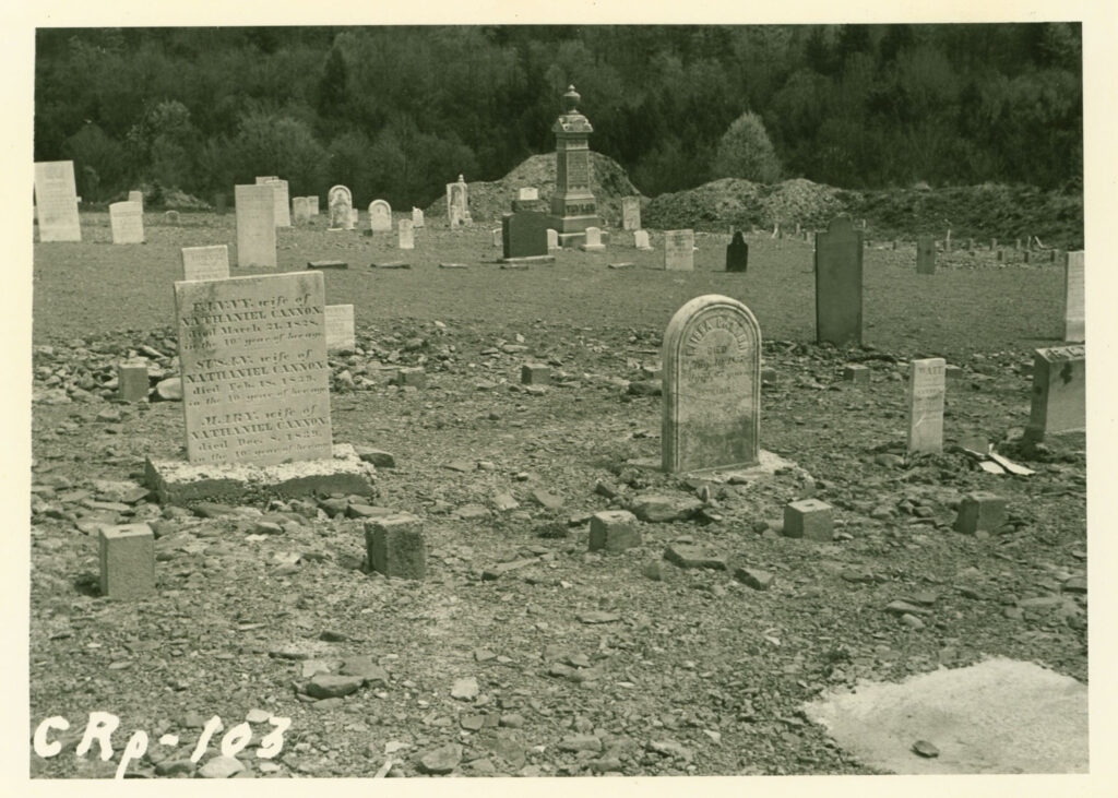
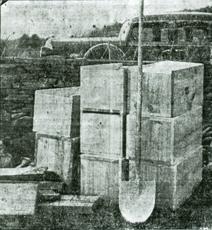
“By 1965, every key waterway in the Catskills, with the exception of the Beaverkill, had been dammed to provide water for New York City. Sixty thousand acres of land had been appropriated, twenty towns and villages had disappeared, six thousand people were driven from their homes, and more than ten thousand graves had been dug up and the bodies moved to other sites, all so New York City could access sixteen hundred square miles of Catskill watershed pouring through the city’s aqueducts.”
—From The Catskills: Its History and How It Changed America by Stephen M. Silverman and Raphael D. Silver
![A black and white photo of tombstones in a cemetary.](http://public-water.com/wp-content/uploads/2021/04/Pepacton_Cemetary_NYCW-1024x731.jpg)
![A black and white photo of a group of wood boxes stacked on top of one another and a shovel leaning against the stack.](http://public-water.com/wp-content/uploads/2021/04/Delaware_Reburial_Boxes_Lackawack.jpg)
Further Reading
“The Price of Water” shared by Time and the Valleys Museum on the museum’s website and Youtube page explore this period in the history of the Catskill/Delaware region and the expansion of the NYC Water Supply. The videos, and the Museum’s exhibits and programs more broadly, share the personal experience and narrative history of the residents of the communities displaced by the City’s waterworks.
Learn more about the communities displaced by the Rondout Reservoir through this digital exhibit created by the Ellenville Public Library & Museum and New York Heritage Collections: Lost Hamlets of the Rondout Reservoir.