From the Supreme Court to the Delaware
Political precedent had changed since the consideration and subsequent scrapping of the Connecticut Housatonic River plan in the early 1900s. When the Schoharie Reservoir was complete, New York City’s daily water intake was rising to 42 million gallons, so the Board of Water Supply began to look into the development of the Delaware River and its tributaries. Despite state approval, the city’s plans to build five more reservoirs were challenged by New Jersey and Pennsylvania, which shared the interstate waters of the Delaware River. The dispute went to the U.S. Supreme Court, which in 1931 allowed New York City to take no more than 440 million gallons of water a day from the river system.
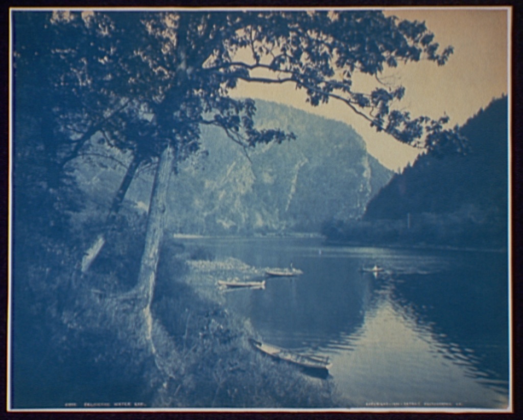
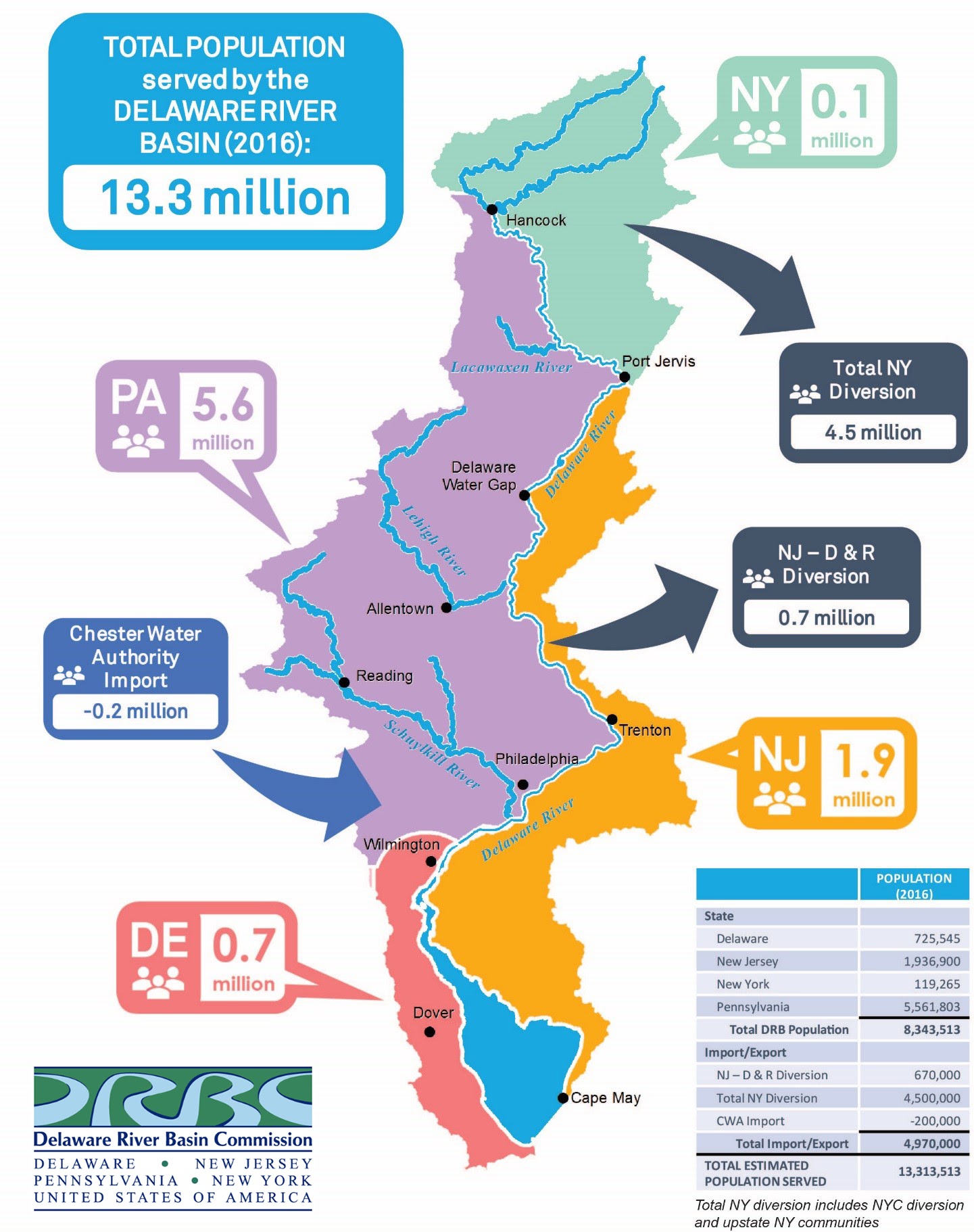
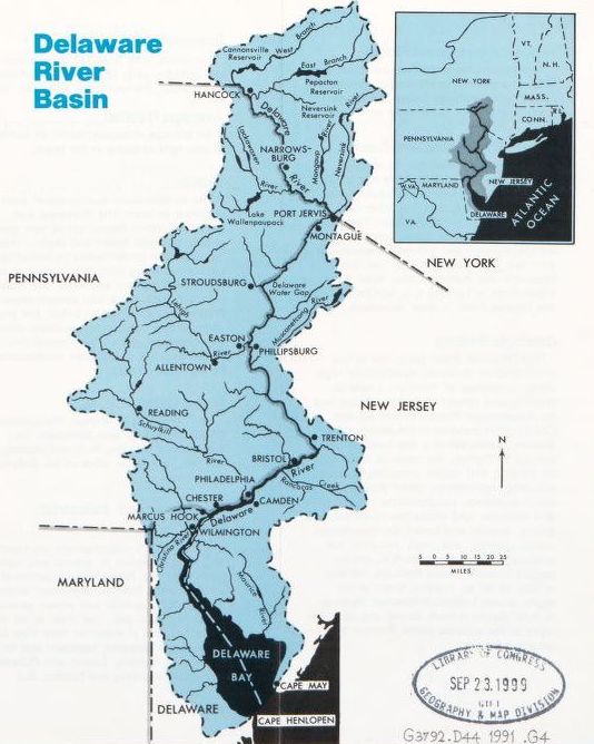
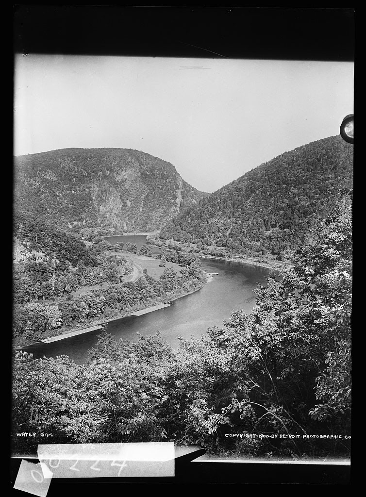
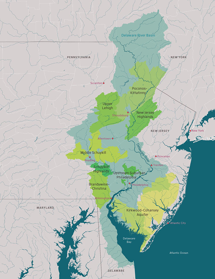
Unlike the Hudson River Watershed, the vast majority of which lies within New York State, the Delaware Watershed encompasses significant portions of Pennsylvania, New Jersey, Delaware, and New York. All 4 states now share access, supplying water to over 13 million people in the mid-Atlantic region.
This multi-state compromise was reached after contested claims to jurisdiction and legal arguments including a case brought by New Jersey, contesting New York’s claims to the Delaware’s water, which reached the Supreme Court in 1931. Ultimately, the court ruling allowed NY access to 440 million gallons a day from the Upper Delaware. Though the city had sought an even greater allotment, this decision provided the legal foundation for the further expansion of the NYC water supply.
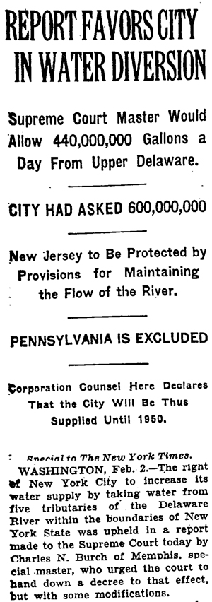
“WASHINGTON, Feb. 2.—The right of New York City to increase its water supply by taking water from five tributaries of the Delaware River within the boundaries of New York State was upheld in a report made to the Supreme Court today by Charles N. Burch of Memphis, special master …”
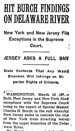
“WASHINGTON, March 16 (AP).— Both New Jersey and New York filed exceptions with the Supreme Court today to the report of Special Master Charles N. Burch in the suit whereby New Jersey seeks to restrain the city of New York from diverting water from the upper branches of the Delaware River.”
“The Delaware River system is the lifeblood of the Mid-Atlantic, supplying drinking water and jobs for millions.”
“The Delaware River basin flows from the Catskill Mountains of New York through Pennsylvania and New Jersey, and into the Atlantic at Delaware Bay. This web of rivers and streams is the lifeblood of the region. It provides drinking water for 15 million people, including the communities of New York City, Trenton, Philadelphia and Wilmington. It sustains orchards, wineries, dairy farms and nurseries. Its free-flowing waters, world-class fisheries, and streamside parks draw anglers, birders, bicyclists and paddlers from across the region and the world.”
“Smart laws and caring landowners have helped clean up historic pollution, but poorly planned development is still a threat. Rain running off roads and parking lots carries oil and chemicals. The loss of trees and native plants that act as natural water filters leads to flooding, and streams clogged with silt, trash and algae.”
— Text by the Delaware River Watershed Initiative on 4states1source.org.