Under the Hudson
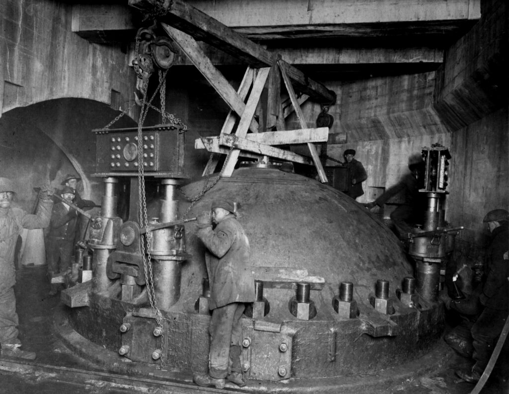
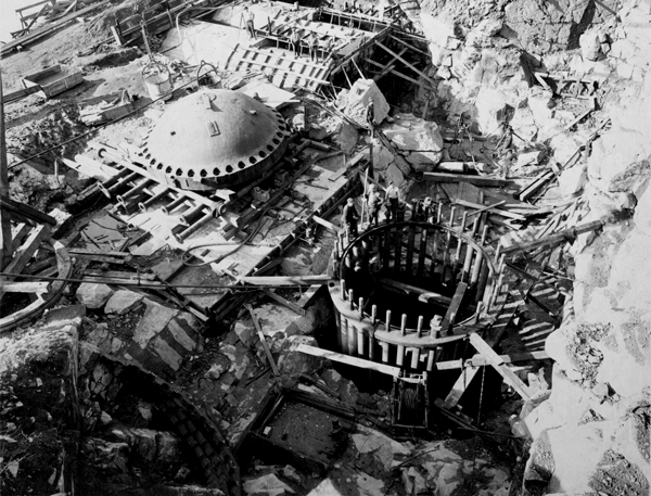
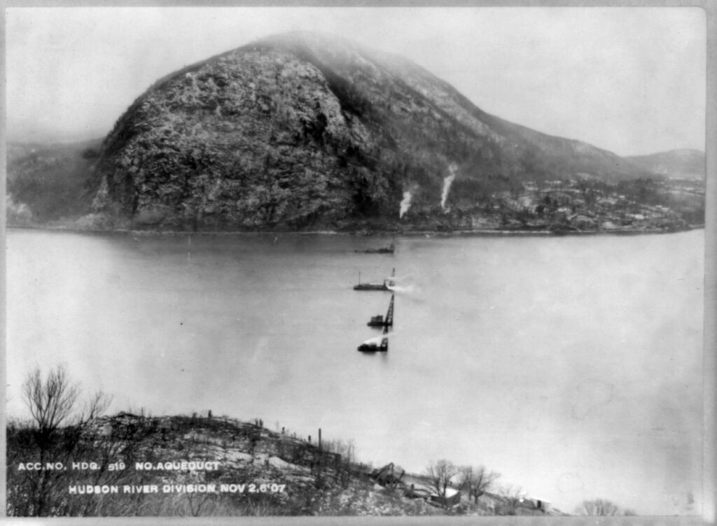
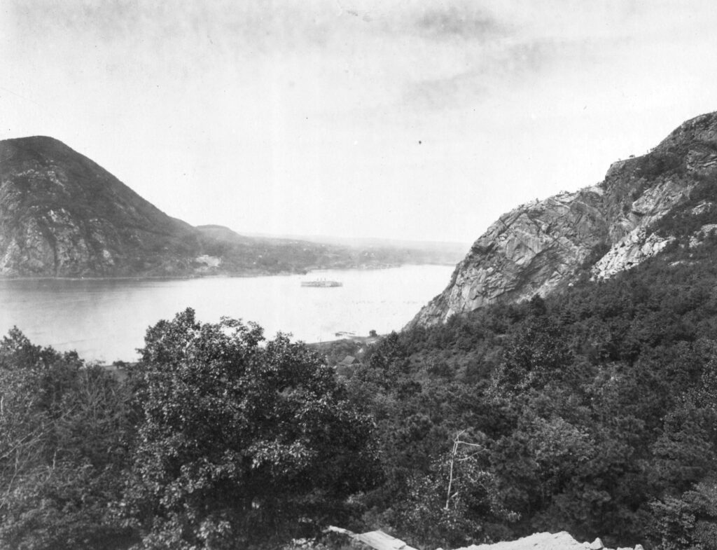
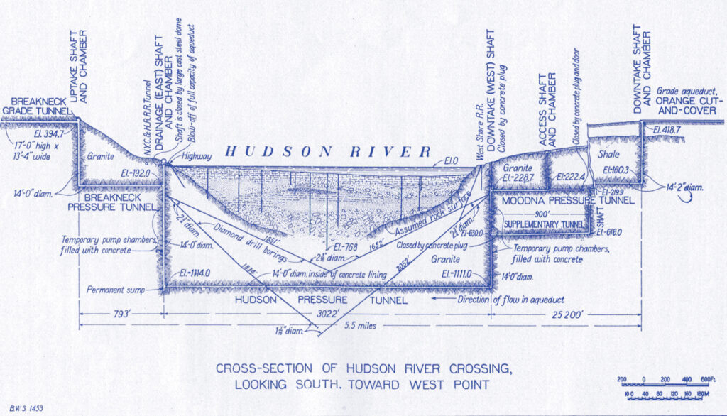
Devising a means to carry water beneath the Hudson River was the most challenging aspect of the Catskill aqueduct construction. Engineers identified the area around Storm King mountain, and began an arduous process (with many failed attempts) of boring into the earth below the riverbed to locate bedrock. The tunnel was eventually built 1,100 ft below ground, which included 950 ft below the Hudson River bedrock. This bedrock buffer between the tunnel and the river bottom allowed the aqueduct to withstand the colossal pressure exerted by the river.
“Glaciers, earthquakes and floods had, over eons, created a patchwork of geological conditions that would ultimately take the aqueduct through what geologists know as the Catskill Plateau, the Great Appalachian Valley, and the mountainous Hudson Highlands, the Piedmont Region of Westchester County and the Coastal Plain represented by Long Island. Plotting an aqueduct through such varying terrain would be no mean feat.”
— From Liquid Assets by Diane Galusha.
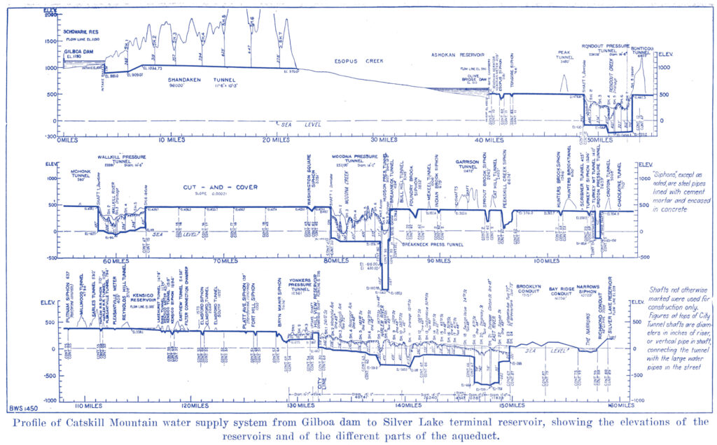
“Starting with a series of buried masonry conduits seventeen feet high and seventeen and a half feet wide running more than thirty miles along the mountain slopes, the aqueduct plunged through thirteen and a half miles of tunnels that had been blasted through solid rock, before dropping deep under the Hudson River and rising up again before finally reaching New York City. Not a single pump was required; the water traveled the entire one hundred miles by gravity.”
— From The Catskills: Its History and How It Changed America by Stephen M. Silverman and Raphael D. Silver

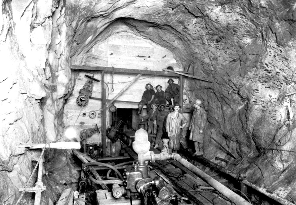
“Field studies and test borings were conducted along the route to determine such things as drainage, location of fold and fault zones, contours of underground bedrock, probable depth of buried gorges and the nature of underground water circulation. These investigations led to two major changes in the aqueduct route as initially proposed: The out-take of the Ashokan Reservoir was shifted from West Hurley to a point nearer the dam site at Olive Bridge to take advantage of more favorable topographical conditions; and the Hudson River crossing, first proposed for New Hamburg, was changed to Storm King further south to avoid several faults, penetration of problematic limestone, and the necessity of building a nine-mile-long pressure tunnel from Marlboro to Fishkill.”
— From Liquid Assets by Diane Galusha.