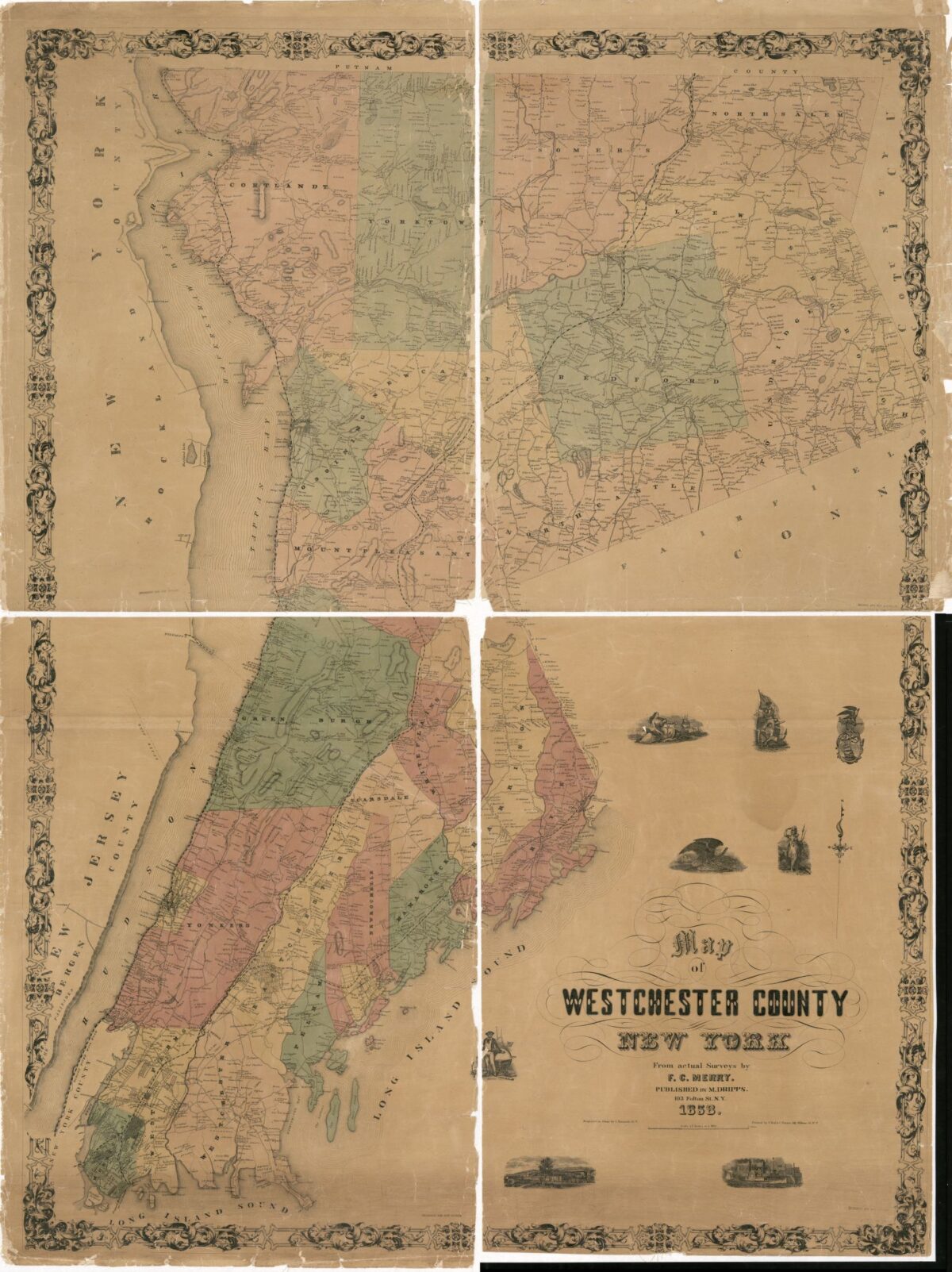
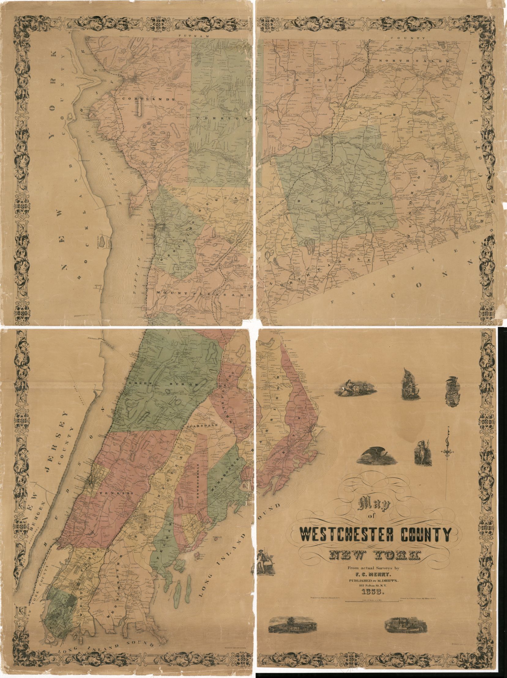
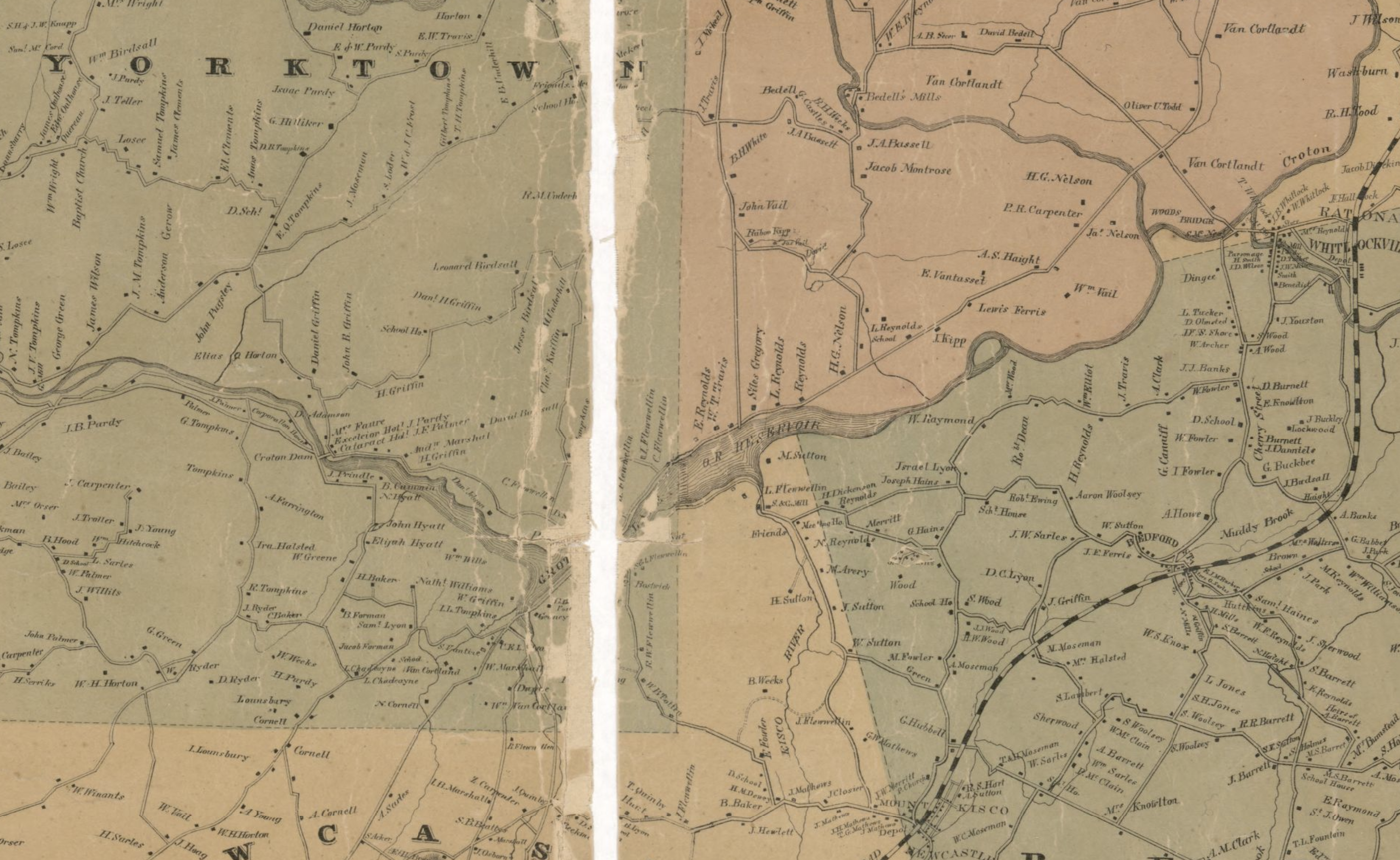
The Old Croton Dam

The Old Croton Dam

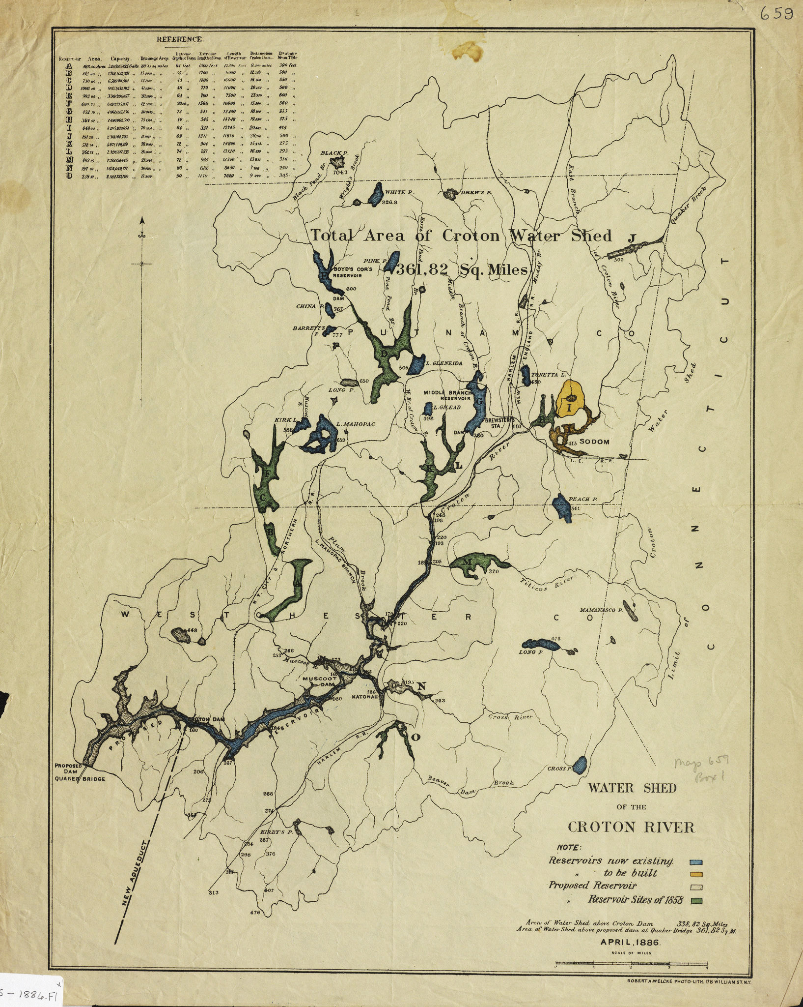
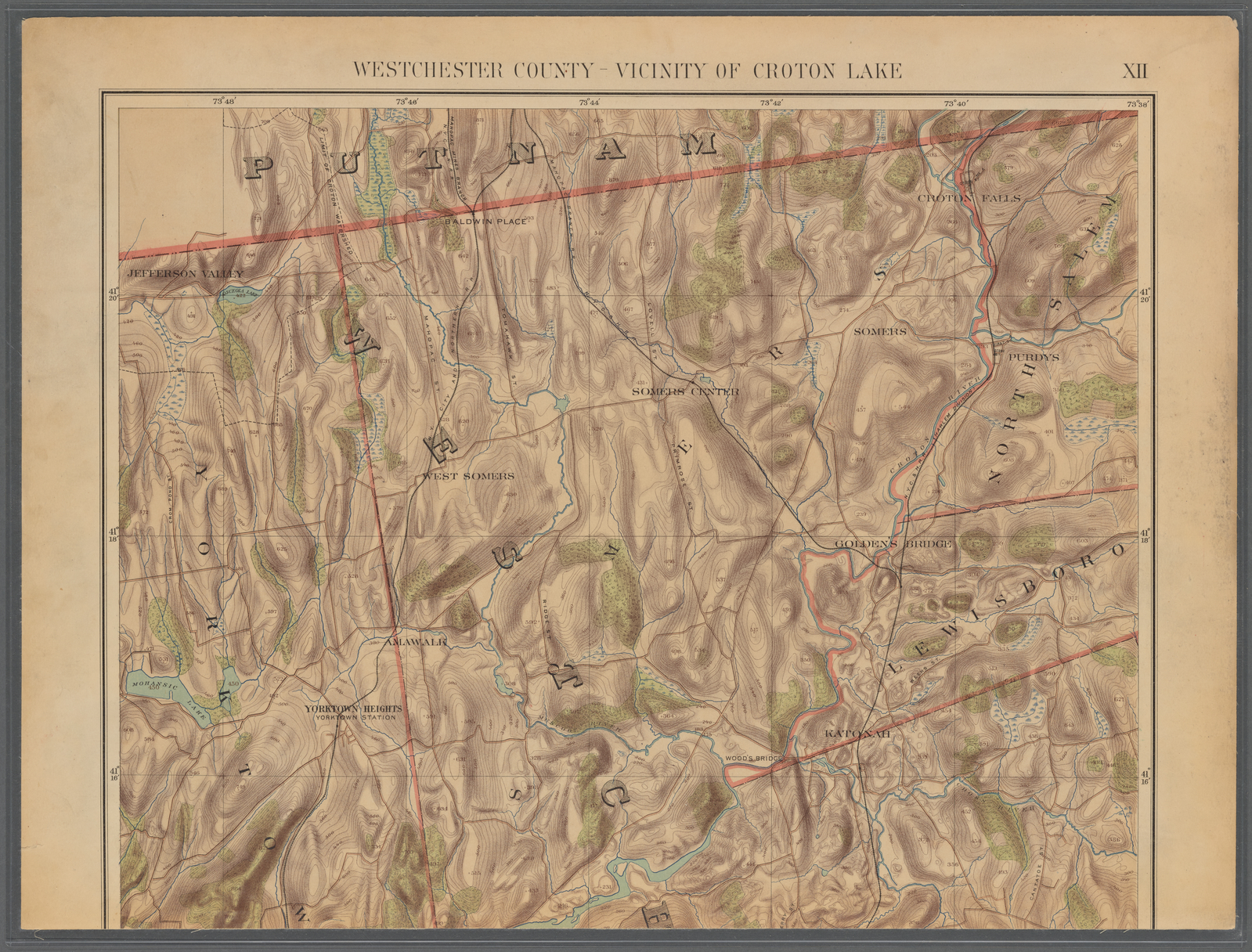
After exploring alternatives, in the late 1820’s, city officials made plans to extract water from the Croton River in Westchester County. The development of the city’s first successful public water supply system was a major engineering undertaking, constructed by almost 4,000 immigrants. The Old Croton Dam created a lake about 400 acres in size. The dam received considerable pushback from Westchester residents, who argued that it “disfigured their fields and divided property.” Water started flowing through the aqueduct on June 22, 1842, bringing water 41 miles from the Croton River to reservoirs in Manhattan. This changed domestic life in the city. Baths and running water were built in the private homes of wealthy New Yorkers, and public bathing facilities were constructed for everyone else. However, the decline in the number of residents drawing water from the city’s wells rose the water table and created floods. In an effort to further sanitation, city agencies also built sewers in many residential streets.

Map of Westchester County, NY from actual surveys. Issued 1858. Source: Library of Congress. Link.
Cropped view of the above map showing the Croton Reservoir. This section is located in the middle of the top half of the larger map.
An illustration of a birds-eye view of a landscape with rivers weaving throughout. The view disappears south with the Hudson River and Long Island Sound almost converging.
Path of the Croton Aqueduct looking south from the Croton River and Old Croton Dam to Manhattan. Source: Scientific American via Friends of the Old Croton Aqueduct website. Link.
Croton Watershed map, 1886.Source: New York Public Library Digital Collection. Link.
Topographic map of Westchester County in the vicinity of Croton Lake. Part of Croton Lake can be seen at the base of the map. Issued 1891. Source: NYPL Digital Collection. Link.
A profile/cross-section of the Croton Aqueduct showing the elevations of parts of the pipeline including Harlem Bridge, York Hill, and parts of Manhattan.
Profile and Ground Plan of the Lower Part of Croton Aqueduct. Compiled under the direction of John B. Jervis, Chief Engineer by Theophilus Schramke. Date of original unknown. Source: John B. Jervis Drawings Digital Collection, Jervis Public Library. New York Heritage Digital Collections. Link.
Two views of the Old Croton Aqueduct, Saw Mill River Culvert, Spanning Nepperhan Avenue, Yonkers, Westchester County, NY. Source: Library of Congress, from survey HAE NY-118. Documentation compiled after 1968. Illustration Link. Photo Link.

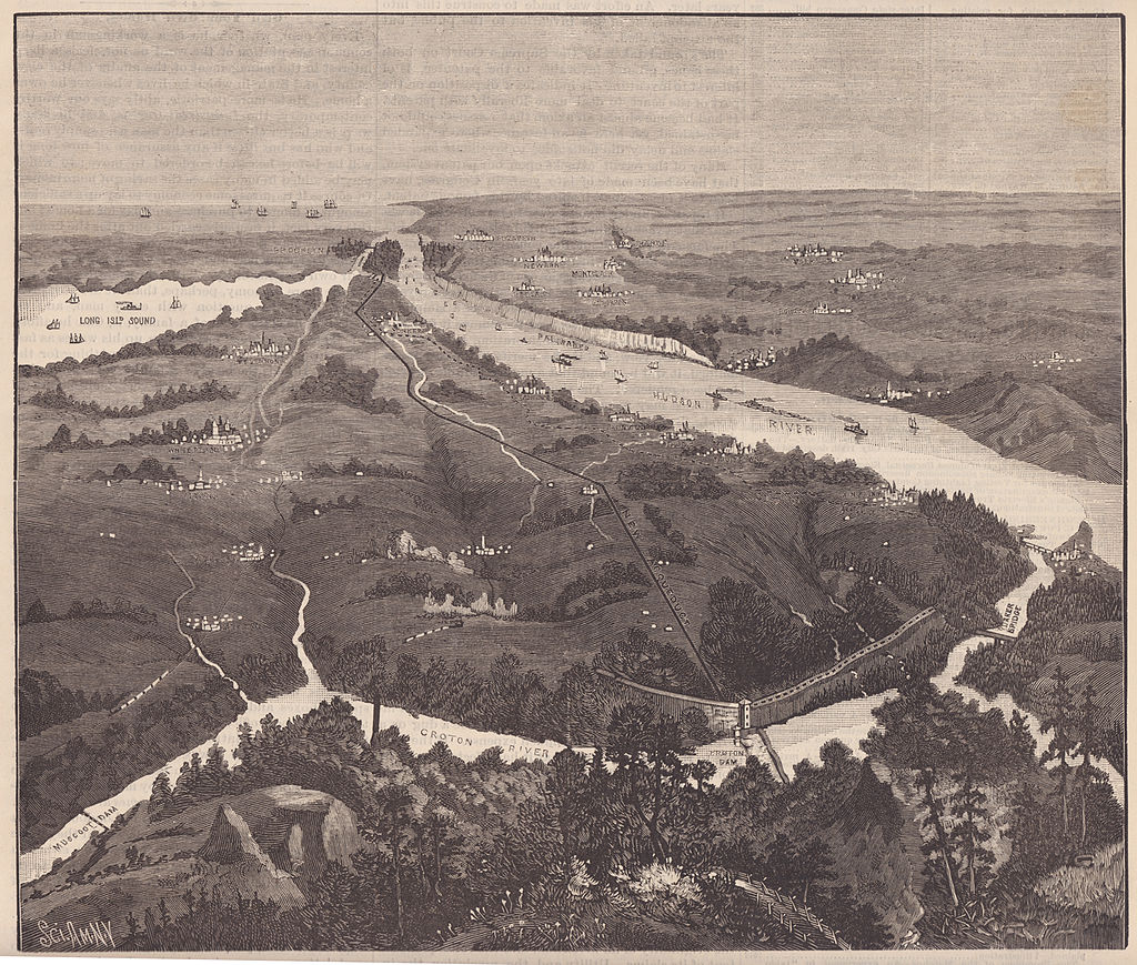
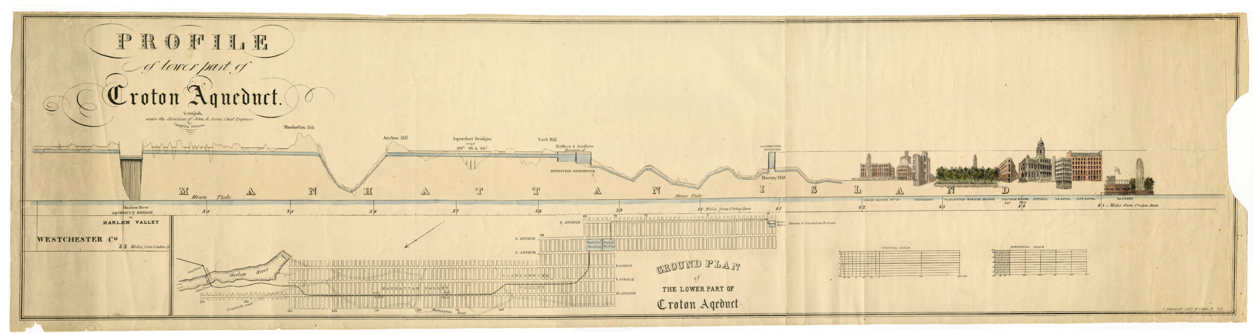
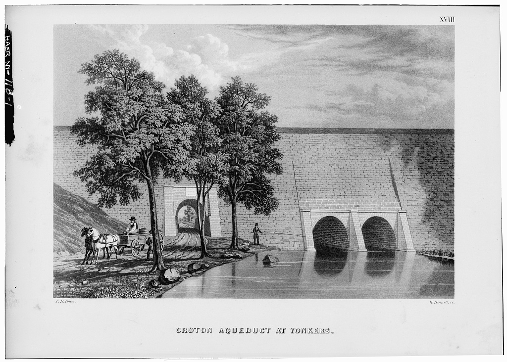
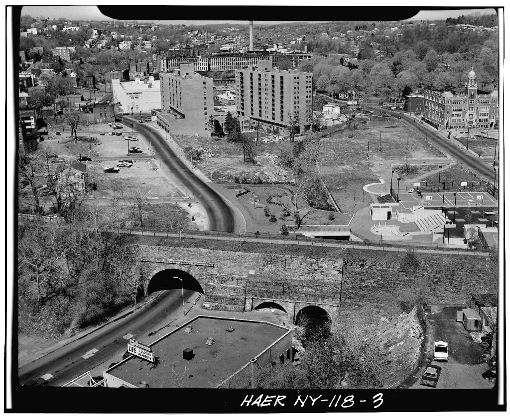
The Old Croton Aqueduct is an outstanding example of 19th century civil engineering and was New York City’s first municipal water project. The culvert at Saw Mill River is notable because, instead of spanning the river with a single arch, Jervis used two smaller arches sharing a common center footing. The roadway arch was altered to over twice its size in the late 19th century.

—Library of Congress note on above documentation.


Old Croton Aqueduct, Ventilator Number 9, Spring & Everett Streets, Ossining, Westchester County, NY. Source: Library of Congress, from survey HAER NY-111. Documentation compiled after 1968. Link.

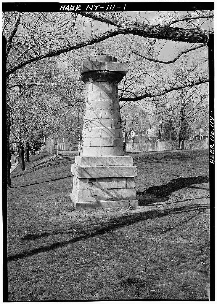
Ventilators played an important role in the function of the Old Croton Aqueduct. Allowing air into the system prevented a build up of pressure, or a vacuum and maintained the freshness of the water.

—Library of Congress note on above documentation.

Left arrow (previous post)
Up arrow (back)
Right arrow (next post)